Sutton Scarsdale
| Sutton Scarsdale | |
| Derbyshire | |
|---|---|
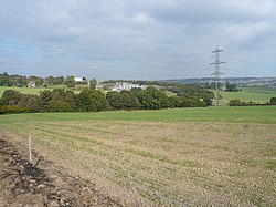
 Across Wrang Plantation towards Park Farm | |
| Location | |
| Grid reference: | SK440686 |
| Location: | 53°12’46"N, 1°20’33"W |
| Data | |
| Population: | 1,523 (2001 (parish)) |
| Post town: | Chesterfield |
| Postcode: | S44 |
| Dialling code: | 01246 |
| Local Government | |
| Council: | North East Derbyshire |
| Parliamentary constituency: |
North East Derbyshire |
Sutton Scarsdale is a very small village in Derbyshire, in the Scarsdale Hundred in the north-east of the county. It is found very close to the M1 motorway.
The village is most noted for a large, ruined former stately home called Sutton Scarsdale Hall.
Nearby are the villages of Heath, Temple Normanton and Arkwright Town.
Early history
This manor is recorded in the Domesday Book of 1086 under the title of “The lands of Roger de Poitou”[1] it said:
In Sutton Scarsdale Stenulf had four carucates of land to the geld. Land for five ploughs. The lord has there one plough and six villeins and one bordar with one plough, There is a mill rendering two shillings and eight acres of meadow. Woodland pasture half a league long and three furlongs broad. In King Edward’s time worth forty shillings, now twenty shillings.[2]
Outside links
| ("Wikimedia Commons" has material about Sutton Scarsdale) |
References
- ↑ Roger de Poitou had a number of manors given to him by the king. Besides Sutton Scarsdale he had Stainsby, South Wingfield, Beighton and Blingsby Gate (sic) in Derbyshire. Although a comment is added "Roger de Poitou had these lands but now they are in the King's hand".
- ↑ Domesday Book: A Complete Translation. London: Penguin, 2003. ISBN 0-14-143994-7 p.744