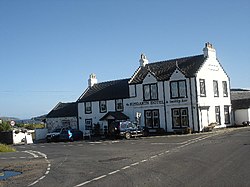
Kingarth
| Kingarth Gaelic: Ceann a' Gharaidh Irish: Cenn Garad | |
| Buteshire | |
|---|---|
 Kingarth Hotel | |
| Location | |
| Grid reference: | NS095563 |
| Location: | 55°45’47"N, 5°2’10"W |
| Data | |
| Post town: | Isle of Bute |
| Postcode: | PA20 |
| Dialling code: | 01700 |
| Local Government | |
| Council: | Argyll and Bute |
| Parliamentary constituency: |
Argyll and Bute |
Kingarth is a historic village and parish on the Isle of Bute in Buteshire. The village is within the parish of its own name,[1] and is situated at the junction of the A844 and B881 roads.[2] In the Early Middle Ages it was the site of a monastery and bishopric and the cult centre of Saints Cathan and Bláán (Anglicized as Blane).
History
Located to the north of Kilchattan Bay, Kingarth was the central religious site for the Cenél Comgaill kindred of Dál Riata (after which Cowal is named), just as Lismore was for the Cenél Loairn and Iona for the Cenél nGabráin.[3] It is half a mile from the early historic hill-fort of "Little Dunagoil", which may have been the chief secular site of the kindred.[4] The centre for Saint Bláán's cult had probably moved to the mainland to Dunblane in Perthshire under the influence of Viking attacks in the 9th century, perhaps like the movement of the relics of Saint Cuthbert to the bishopric of Lindisfarne and those of Saint Columba to the bishopric of Dunkeld.[5]
Despite this, it survived as a religious site to become one of only two parish churches on the island, the other being Rothesay; it was part of the diocese of the Isles, though perhaps originally in the diocese of Argyll.[6] Alan fitz Walter tried to grant the church to Paisley Abbey in 1204, but this grant does not appear to have been effective and it remained an independent parsonage until the 15th-century.[7] In 1463 it became a prebend for the newly created chapter of the diocese of the Isles, but in 1501 it was annexed to the Chapel Royal at Stirling, becoming in 1509 a prebend for the chancellorship of the Chapel Royal, the latter arrangement surviving beyond the Reformation.[7]
References
- ↑ "Details of Kingarth". Scottish Places. http://www.scottish-places.info/towns/towndetails3910.html. Retrieved 31 December 2014.
- ↑ "A844". Sabre. http://www.sabre-roads.org.uk/wiki/index.php?title=A844. Retrieved 31 December 2014.
- ↑ James E. Fraser (historian) (2009), From Caledonia to Pictland: Scotland to 795, The New Edinburgh History of Scotland, 1, Edinburgh: Edinburgh University Press, pp. 157, 372, ISBN 978-0-7486-1232-1
- ↑ James E. Fraser (historian) (2009), From Caledonia to Pictland: Scotland to 795, The New Edinburgh History of Scotland, 1, Edinburgh: Edinburgh University Press, p. 157, ISBN 978-0-7486-1232-1
- ↑ Alex Woolf (2007), From Pictland to Alba, 789–1070, The New Edinburgh History of Scotland, Edinburgh: Edinburgh University Press, p. 102, ISBN 978-0-7486-1234-5
- ↑ Cowan, Ian B. (1967), The Parishes of Medieval Scotland, Scottish Record Society, vol. 93, Edinburgh: Neill & Co. Ltd, pp. 112, 174
- ↑ 7.0 7.1 Cowan, Ian B. (1967), The Parishes of Medieval Scotland, Scottish Record Society, vol. 93, Edinburgh: Neill & Co. Ltd, p. 112
Outside links
| ("Wikimedia Commons" has material about Kingarth) |