Gaunt's Earthcott
| Gaunt's Earthcott | |
| Gloucestershire | |
|---|---|

| |
| Location | |
| Grid reference: | ST638841 |
| Location: | 51°33’18"N, 2°31’23"W |
| Data | |
| Postcode: | BS32 |
| Local Government | |
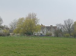
Gaunt's Earthcott, otherwise written Gaunts Earthcott, is a hamlet in the parish of Almondsbury in Gloucestershire. It consists of a ruined chapel, a few houses and two farms, Green Farm and Court Farm.
The village is to be found some two and a half miles from Rudgeway and the A38 road and about the same distance from Frampton Cotterell and Winterbourne. It is rural, and is has no real industry as such, the main economic activity in the area is farming, but it is close to the interchange between the M4 and M5 motorways, beyond which is Patchway and the beginning of the swelling townscape that spreads almost unbroken from Bristol.
To the northeast of Gaunt's Earthcott is a similarly named hamlet: Earthcott Green, on the B4059 road between the A38 and Yate.
| ("Wikimedia Commons" has material about Gaunt's Earthcott) |
References
