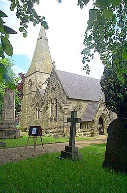
Brackenfield
Jump to navigation
Jump to search
| Brackenfield | |
| Derbyshire | |
|---|---|
 Brackenfield Church. | |
| Location | |
| Grid reference: | SK372591 |
| Location: | 53°7’40"N, 1°26’44"W |
| Data | |
| Population: | 214 (2011) |
| Post town: | Alfreton |
| Postcode: | DE55 |
| Dialling code: | 01629 |
| Local Government | |
| Council: | North East Derbyshire |
| Parliamentary constituency: |
North East Derbyshire |
Brackenfield is a village in north-eastern Derbyshire, about five miles east of Matlock and four and a half miles north-west of Alfreton. It is also close to Clay Cross. Set in farming country, the village is located around a large village green. The parish of Brackenfield includes much of the attractive Ogston Reservoir.[1]
The population of the civil parish as of the 2011 census was 214.
Brackenfield was originally known as Brackenthwaite, which probably meant "a bracken clearing". The village later became known as Brackenfeld, and then Brackenfield.
The parish of Brackenfield was originally a township of nearby Morton. It was divided from it in 1758.
Outside links
| ("Wikimedia Commons" has material about Brackenfield) |
References
- ↑ Brackenfield: Derbyshire UK