Matlock
| Matlock | |
| Derbyshire | |
|---|---|
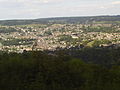
 Matlock viewed from the nearby Riber Castle | |
| Location | |
| Grid reference: | SK298601 |
| Location: | 53°8’24"N, 1°33’0"W |
| Data | |
| Population: | 10,689 |
| Post town: | Matlock |
| Postcode: | DE4 |
| Dialling code: | 01629 |
| Local Government | |
| Council: | Derbyshire Dales |
| Parliamentary constituency: |
West Derbyshire |
Matlock is a town in Derbyshire. It stands in the hills at the south-eastern edge of the Peak District. The former spa resort of Matlock Bath lies immediately south of the town on the A6.
Matlock as a town, has a population of 10,689 but taking into account its satellite villages and hamlets (including Darley Dale, Tansley, Hackney and Matlock Bath) would bring that figure up to some 20,000 souls. Here the hills are somewhat gentler than the fierce slopes and moorland of the Peak, the area hereabouts being known as the Derbyshire Dales.
The town's name is believed to derive from Mot ac, the Old English for "Moot Oak"[1])
Matlock is nine miles south-west of Chesterfield and nineteen miles north of the county town, Derby.
Churches
- Church of England:
- St Giles
- All Saints
- Holy Trinity (Matlock Bath)
- St Helens (Darley Dale)
- Assemblies of God: Dales Christian Centre
- Independent Evangelical: Steep Tunpike
- Methodist & United Reformed Church: [www.mmurc.org.uk/ Matlock Methodist a United Reformed Church]
- Roman Catholic: Our Lady & St Joseph
History
A former spa town, Matlock lies on the River Derwent, and has prospered from both the hydrotherapy industry and the mills built on the river and its tributary the Bentley Brook. Once it was collection of small villages — Matlock Town, Matlock Green, Matlock Bridge, Matlock Bank — until thermal springs were discovered in 1698.[2]
The population increased rapidly in the 1800s, largely due to the popurity of the hydropathic establishments built at the time.[3] At one stage there were around twenty "hydros", most on Matlock Bank. The largest was built in 1853 by John Smedley.[2][3] This closed in 1955,[3] and re-opened in 1956 [4] as the headquarters of Derbyshire County Council: this and Derbyshire Dales District Council which also has a headquarters here, are major employers in the town.
Hall Leys Park
Hall Leys Park is a large Victorian park in Matlock next to the River Derwent. It opened in 1898. The park has a miniature railway, bandstand and a boating pond, with the oldest running powered boats in Britain, for many years, as well as tennis courts and a war memorial.
There is project to update and upgrade all the parks in the Matlock area - Hall Leys Park was the first to benefit from this and the children's play area has been greatly modernised. There has also been a skateboard park added replacing grass tennis courts.
The park hosts an arts festival, Matlock Live, every June and the Matlock Victorian Christmas Weekend on the first weekend of December.
Bank Road

Bank Road runs from Crown Square up Matlock Bank, a steep hill which gives the road its name, to Wellington Street. The road has many local landmark buildings along it. From the foot of the hill at Crown Square travelling north:
- The Crown Hotel - the original site of the hotel which gave its name to Crown Square is now a building society office. This was built before 1899.[5] The Crown is now a pub just along Bakewell Road.
- Crown Buildings, opposite the original Crown Hotel at the bottom of Bank Road, was built in 1889 [5] and currently houses a café on its ground floor.
- Post Office and Sorting Office. These were built before 1922.[5]
- Police Station - built after the second world war.[3]

- District Council Offices - Formerly Bridge Hall, then a hydro called Bridge House (established by 1861). In 1894 the Matlock Urban District Council bought Bridge House hydro for use as the Town Hall and added a large wing in the Italianate style to house an assembly room etc. It was reopened in 1898 and also housed most local authority undertakings, magistrates courts, etc.[6] Following local government reorganisation in 1974, the Town Hall became the headquarters of West Derbyshire District Council (which later changed its name to Derbyshire Dales District Council). To enable the District Council to centralise its several offices spread over the district, the Town Hall was substantially extended in 1979.
- Our Lady & St Joseph's Catholic Church - built in 1883 with a presbytery added in 1896. The church was described as a 'mission', established under St Mary's of Derby. A church hall was built alongside in the 1990s.[6]
- Youth Hostel - Built in 1882 as Smedley Memorial Hospital. There is a later (Hunter) wing with a datestone of 1897 set further back from the road. The Youth Hostel opened in 1983 and closed on 30 September 2007.[6]
- Matlock Methodist & United Reformed Church - originally Matlock Wesleyan Chapel, and later the Trinity Methodist Church. The church was designed by C.O. Ellison of Liverpool, with additions designed by Horace G. Bradley. The neo-gothic church was originally built in 1882 without the slender steeple, which is now a landmark feature reaching above the roofs of neighbouring buildings, and, from higher levels, an elegant feature against the backdrop of the hills beyond. The Manse was built at the west of the site, fronting New Street.[6]
- Old Sunday School - which is now a bed and breakfast.
- Old Methodist Church - the Primitive Methodist congregation was founded in 1838, although the current church on Bank Road, opposite the entrance to County Hall, was rebuilt in 1856 and the adjacent School Room below was added in 1878.[6] Until recently, the Old Methodist Church housed the Matlock Wurlitzer.[7]
- County Hall - formerly Smedley's Hydro, is a Grade-II listed building which dominates Matlock Bank. The earliest (western) section seen today was built in c.1867 by Smedley. Much of today's building was added after Smedley's death in 1874. The first phase, in 1881, included the entrance hall and staircase, now in the middle section. In 1886, the eastern section was added by architect George Statham of Nottingham. Later extensions include the tall chimney, impressive for its height on the already prominent site, along with boiler house and bath in 1894. The domed glass Winter Gardens, which housed a ballroom, and the northern block on the other side of Smedley Street were added in 1901. The northern block was linked by the unusual two storey bridge over Smedley Street.[6]

The hydro closed in 1955.

- The Gate public house - There were known to have been numerous public houses on Matlock Bank, thought to have been the result of the ban on alcohol consumption within the hydros themselves, especially at Smedley's. The whereabouts of many is no longer known. The Gate (dated 1869) was one of these, and still stands on the corner of Smedley Street and Bank Road, opposite Smedley's.[6]
Rutland Street (the continuation of Bank Road):

- Rutland Court - the former Matlock House Hydro stands prominently on the east side of Rutland Street. The hydro was built in 1863 and an engraving of 1870 shows that the main block, at least that which is visible from the roadside today, is largely unaltered.[6]
- Elmtree House - a former hydro, now 70-74 Rutland Street, was opened in 1862. It is located just to the north of the dominant Matlock House (now Rutland Court).[6]
- The Old Tram Depot - now a garage

- Rockside Hydro - an imposing building with views across Matlock, is a grade II listed building, on higher ground above Smedley's and is distinctive for its two octagonal corner turrets with conical roofs topped by lanterns. Rockside was built circa 1860, but extended significantly by the firm of arcitects Parker and Unwin between 1901 and 1905, The building was also extended later in 1923 and 1928. An upper floor glazed conservatory with a glazed curved roof was added in c. 1923, and a block was added on Cavendish Road in 1928.[6] It probably isn't so well known that during the Second World War, Rockside Hall was used as an RAF psychiatric hospital, where mentally-scarred service personnel (mostly aircrew) were rehabilitated. It was somewhat unkindly known as "Hatters Castle" by locals.[8] The building became a hall of residence to Matlock College of Further Education in 1950 but following closure, stood empty and derelict for many years but has recently been renovated and converted into apartments. Large sections have been replaced, including the Cavendish Road block and the curved conservatory roof.
Picture gallery
-
 Matlock morning view from east, Lumsdale.
 -
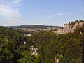
 Matlock viewed from a nearby ridge.
 -
 The town enjoys the Sun's rays as shade approaches.
 -
 The town as seen from the nearby cable cars.


References
- ↑ Matlock A Key To English Placenames, English Place Name Society database
- ↑ 2.0 2.1 "Matlock & Matlock Bath: Water Cures", Matlock & Matlock Bath (The Andrews Pages), http://www.pd65.dial.pipex.com/matlock/water.htm, retrieved 2 June 2010
- ↑ 3.0 3.1 3.2 3.3 "Matlock Bank: Conservation Area Appraisal. 02: Origins & Development", Matlock Bank Conservation Area, Derbyshire Dales District Council, December 2007, http://www.derbyshiredales.gov.uk/Images/2%20Origins%20and%20Development_tcm19-83827.pdf, retrieved 28 June 2010. See downloadable attachments at bottom of page.
- ↑ "Matlock County Hall". Derbyshire Arts Partnership. http://www.artsderbyshire.org.uk/find_artist/articles/Derbyshire_Heritage_Places_Matlock_County_Hall.html. Retrieved 2010-12-28.
- ↑ 5.0 5.1 5.2 "Matlock Bridge Conservation Area Architecture". Derbyshire Dales District Council. http://www.derbyshiredales.gov.uk/Images/Matlock%20Bridge%20Conservation%20Area%20Appraisal%20-%2004%20-%20Architectural%20and%20Historic%20Quality_tcm19-83858.pdf. Retrieved 2011-01-01.
- ↑ 6.00 6.01 6.02 6.03 6.04 6.05 6.06 6.07 6.08 6.09 "Matlock Bank Conservation Area Architecture". Derbyshire Dales District Council. http://www.derbyshiredales.gov.uk/Images/Matlock%20Bank%20Conservation%20Area%20Appraisal%20-%2004%20-%20Architectural%20and%20Historic%20Quality%20-%20Part%201_tcm19-83831.pdf. Retrieved 2011-01-01.
- ↑ "Matlock Wurlitzer". Theatre Organs website. http://theatreorgans.com/au/opus/UPDATES/UD2192.htm. Retrieved 2011-01-01.
- ↑ "Rockside Hall photo". Geograph website. http://www.geograph.org.uk/photo/614906. Retrieved 2011-01-01.
Outside links
- Extensive site on the history of Matlock and Matlock Bath.
- Remarkably extensive, well-presented bibliog. of writings on Matlock and Matlock Bath
- Matlock Live! website
- Matlock news from the Derby Telegraph
- Matlock Music website
- For descriptions of Matlock over several centuries.
- Matlock Mercury, local newspaper
- Matlock Footbridge Campaign