Treen (Zennor)
From Wikishire
Revision as of 14:01, 26 March 2013 by RB (Talk | contribs) (Created page with '{{Infobox town |name=Treen |cornish=Tredhin |county=Cornwall |picture=The hamlet of Treen - geograph.org.uk - 1241901.jpg |picture caption= |os grid ref=SW4337 |latitude=50.185 …')
| Treen Cornish: Tredhin | |
| Cornwall | |
|---|---|

| |
| Location | |
| Grid reference: | SW4337 |
| Location: | 50°11’6"N, 5°35’24"W |
| Data | |
| Post town: | ST IVES |
| Postcode: | TR26 |
| Dialling code: | 01736 |
| Local Government | |
| Council: | Cornwall |
| Parliamentary constituency: |
St Ives |
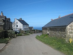
Treen is a hamlet in the parish of Zennor, on the north coast of the Penwith peninsula in Cornwall. It lies along the B3306 road which connects St Ives to the A30 road.
Nearby on the coast is Gurnard's Head, one of the many cliff castles on the Cornish coast and was formerly a Coastguard Lookout. To the east of Gurnard's Head is Treen Cove. The area is owned by the National Trust.
The Gurnard's Head Hotel is on the B3306 and in the 1960s was noted for a totem pole at the front of the building.
This Treen is not to be confused with the larger village of Treen close by, on the south coast of the Penwith peninsula, less than 10 miles away.
Outside links
| ("Wikimedia Commons" has material about Treen (Zennor)) |