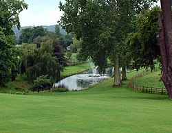
Titsey
| Titsey | |
| Surrey | |
|---|---|
 Titsey Place Gardens | |
| Location | |
| Grid reference: | TQ408549 |
| Location: | 51°16’35"N, 0°1’6"E |
| Data | |
| Postcode: | RH8 |
| Local Government | |
| Council: | Tandridge |
| Parliamentary constituency: |
Tandridge |
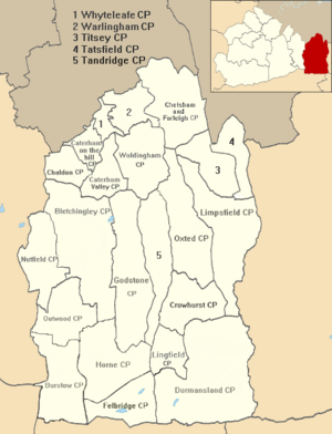
Titsey is a small village in eastern Surrey, in the Tandridge Hundred. The eastern parish boundary follows the London to Lewes Way, a Roman road which descends the escarpment of the North Downs here, crossing two important ancient east-west routes, the North Downs ridgeway and the Pilgrims Way on the lower slopes.[1]
Titsey appears in Domesday Book of 1086 as Ticesei. It was held by Haimo the Sheriff (of Kent). Its Domesday assets were: 2 hides; 1 church, 9 ploughs, pasture worth every seventh hog of the villains. It rendered £11.[2]
Geography
Titsey covers the near crest, the southern edge of the North Downs with the part known as Botley Hill, the highest point of the range in the parish. Springs in Titsey, rising at the foot of the chalk scarp of the North Downs, are the source of the River Eden.[3][4]
Outside links
| ("Wikimedia Commons" has material about Titsey) |
- Explore Britain — Titsey Wood
- Parish Council Clerk — contact details
- Nore Hill Chalk Pinnacle - Surrey Wildlife Trust
References
- ↑ Margary (1948: 130)
- ↑ Surrey Domesday Book
- ↑ Long, George; Porter, George (1850). The geography of Great Britain. London: Woodall. p. 50. OCLC 33113443.
- ↑ Wooldridge, Sidney; Hutchings, Geoffrey (1957). "The scarp-zone foot". London's Countryside: Geographical Field Work for Students and Teachers of Geography. London: Methuen. p. 153. OCLC 519129.
