Difference between revisions of "Stoer Head"
m |
|||
| Line 1: | Line 1: | ||
[[File:Stoer Head - geograph.org.uk - 877199.jpg|right|thumb|350px|Stour Head]] | [[File:Stoer Head - geograph.org.uk - 877199.jpg|right|thumb|350px|Stour Head]] | ||
{{county|Sutherland}} | {{county|Sutherland}} | ||
| − | '''Stoer Head''' is a headland north of [[Lochinver]] and the township of [[Stoer]] in [[Sutherland]], marking the northern entrance to [[the Minch]]. A lighthouse, the [[ | + | '''Stoer Head''' is a headland north of [[Lochinver]] and the township of [[Stoer]] in [[Sutherland]], marking the northern entrance to [[the Minch]]. A lighthouse, the [[Stoer Head Lighthouse]], stands on the point. |
==Geography== | ==Geography== | ||
Revision as of 14:45, 14 February 2019

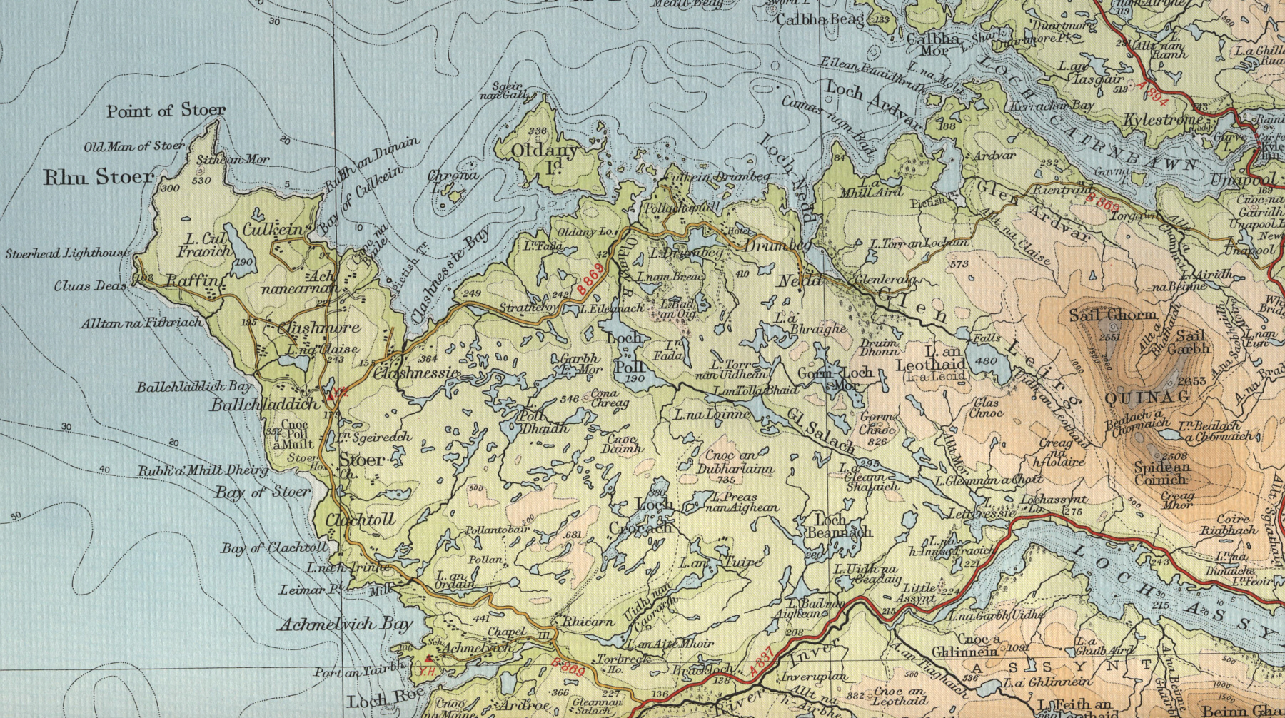
Stoer Head is a headland north of Lochinver and the township of Stoer in Sutherland, marking the northern entrance to the Minch. A lighthouse, the Stoer Head Lighthouse, stands on the point.
Geography
The peninsula is about four miles long and two miles wide. It has a number of scattered, small settlements including Culkein, Balchladich and Achnacarnin. The lighthouse is at the end of a track three miles long which branches off the B869 Lochinver to Unapool road.[1] Further North up the coast are the Old Man of Stoer and the Point of Stoer, which can easily be reached from the lighthouse on foot.[1][2]
Around 10,000 visitors visit the lighthouse each year (necessitating the construction of a public toilet in 2013).[3] The two keepers' cottages are now holiday homes.[4]

Location
- Streetmap: NC019330
- Location map: 58°14’29"N, 5°22’31"W
Outside links
| ("Wikimedia Commons" has material about Stoer Head Lighthouse) |
- Stoer Peninsula on Undiscovered Scotland
- Stoer Head Lighthouse - Northern Lighthouse Board
- Stoer Head Lighthouse Accommodation