Difference between revisions of "Millthorpe, Derbyshire"
From Wikishire
(Created page with "{{Infobox town |name=Millthorpe |county=Derbyshire |picture=Ford across the stream in Mill Lane, Millthorpe, Derbyshire - geograph.org.uk - 472312.jpg |picture caption=A ford...") |
(No difference)
|
Latest revision as of 17:39, 30 July 2021
| Millthorpe | |
| Derbyshire | |
|---|---|
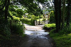
 A ford in Millthorpe | |
| Location | |
| Grid reference: | SK318763 |
| Location: | 53°16’58"N, 1°31’22"W |
| Data | |
| Postcode: | S18 |
| Local Government | |
Millthorpe is a small village in Derbyshire, in the Cordwell Valley in the north-east of the county, within the Peak District. The village is a mile south of Holmesfield and two and a half miles south-west of Dronfield town centre.
The Peak District Boundary Walk runs through Millthorpe.[1]
References
- ↑ McCloy, Andrew (2017). Peak District Boundary Walk: 190 Miles Around the Edge of the National Park. Friends of the Peak District. ISBN 978-1909461536.