Difference between revisions of "Fannichs"
From Wikishire
| Line 22: | Line 22: | ||
*Meall Gorm southeast top, 3,025 | *Meall Gorm southeast top, 3,025 | ||
| − | + | All but An Coileachan are in the Fannich Forest (the Cromartyshire part) or on its border, and An Coileachan's lower slopes are in that part too. The Forest is not a wooded area but a forest in the mediæval sense or an open, unfenced area. | |
{{Catself}} [[Category:Mountains and hills]] [[Category:Cromartyshire]] [[Category:Ross-shire]] | {{Catself}} [[Category:Mountains and hills]] [[Category:Cromartyshire]] [[Category:Ross-shire]] | ||
Revision as of 10:14, 5 August 2014
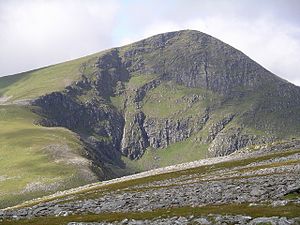
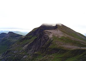
The Fannichs are a range of mountains in Wester Ross in the land between Loch Fannich, Loch a Bhraoin and Loch Glascarnoch. This area is split between a detached part of Cromartyshire and Ross-shire, approximately half in each shire.
The Fannichs, though small in area, have no fewer than 9 munros, which is to say mountains of over 3,000 feet, and 4 munro tops.
The munros are:
- Sgurr Mor, 3,642 feet (Cromartyshire's county top)
- Sgurr nan Clach Geala 3,586 feet
- Sgurr Breac, 3,278 feet
- A' Chailleach, 3,271 feet
- Beinn Liath Mhor Fannaich, 3,130 feet
- Meall Gorm, 3,113 feet
- Meall a' Chrasgaidh, 3,064 feet
- An Coileachan, 3,028 feet
- Sgurr nan Each, 3,028 feet
The tops are:
- Meall nam Peithirean, 3,196 feet
- Carn na Criche, 3,153 feet
- Toman Coinich, 3,068 feet
- Meall Gorm southeast top, 3,025
All but An Coileachan are in the Fannich Forest (the Cromartyshire part) or on its border, and An Coileachan's lower slopes are in that part too. The Forest is not a wooded area but a forest in the mediæval sense or an open, unfenced area.

