Flaunden
| Flaunden | |
| Hertfordshire | |
|---|---|
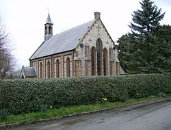
 St Mary Magdalene Church, Flaunden | |
| Location | |
| Grid reference: | TL017009 |
| Location: | 51°41’51"N, -0°31’39"W |
| Data | |
| Postcode: | HP3 |
| Local Government | |
| Council: | Dacorum |
| Parliamentary constituency: |
South West Hertfordshire |
Flaunden is a village in Hertfordshire standing on the Buckinghamshire-Hertfordshire border. Old Flaunden was on the banks of the River Chess in Buckinghamshire but owing to constant flooding was moved up the hill into Hertfordshire in the early 19th century.[1]
The new church at the top of the hill was built in 1838 and was designed by Sir George Gilbert Scott.[2] The old church may be ruined and found overgrown with trees in the meadow by the river.
There was also a Baptist chapel in Flaunden, and the graveyard remains.
Flaunden has two pubs; The Bricklayers Arms and The Green Dragon.[3]
Outside links
| ("Wikimedia Commons" has material about Flaunden) |
