Babbs Green
| Babbs Green | |
| Hertfordshire | |
|---|---|
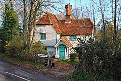
 Crooked Chimneys Cottage, Babbs Green | |
| Location | |
| Grid reference: | TL392160 |
| Location: | 51°49’33"N, -0°1’9"E |
| Data | |
| Postcode: | SG12 |
| Local Government | |
Babbs Green is a hamlet in Hertfordshire, on a stream feeding the River Ash to the east of Ware. The village of Wareside lies immediately to the south. The Greenwich Meridian runs close by Babbs Green.
Outside links
| ("Wikimedia Commons" has material about Babbs Green) |

This Hertfordshire article is a stub: help to improve Wikishire by building it up.
