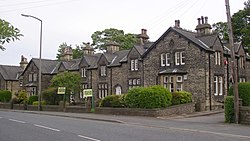
Lightcliffe
| Lightcliffe | |
| Yorkshire West Riding | |
|---|---|
 Wakefield Road, Lightcliffe | |
| Location | |
| Grid reference: | SE140253 |
| Location: | 53°43’27"N, 1°47’21"W |
| Data | |
| Population: | 11,308 |
| Post town: | Halifax |
| Postcode: | HX3 |
| Dialling code: | 01422 |
| Local Government | |
| Council: | Calderdale |
| Parliamentary constituency: |
Calder Valley |
Lightcliffe is a village in the West Riding of Yorkshire, found about three miles east of Halifax and two miles north-west of Brighouse.
The village today is a commuter village for people working in Halifax, Brighouse, and Bradford, and commuting to Leeds, Manchester, and Sheffield.[1] It stretches along the Wakefield and Leeds roads, surrounded by fields and rolling countryside. Lightcliffe feels very established and green – with many mature trees and large houses. Lightcliffe's main park, "the Stray", is 11 acres of lawn and trees and contains a war memorial erected in 1923. In April 1937, an avenue of trees was planted in the park to commemorate King George VI's coronation. Towards the village centre is the cricket club. There are two golf clubs, the long established Lightcliffe Golf Club and Crow's Nest Golf Club.
The oldest part of the village contains the Sun Inn – a former coaching inn, along what was in antiquity the main road to London. The new Lightcliffe Anglican church, St Matthew's, was built in 1875 to replace the old church. It is a Gothic Revival building, with an Battlement|embattled parapet which is reminiscent of a mediæval castle.[2]
| ("Wikimedia Commons" has material about Lightcliffe) |
References
- ↑ "Profile on...". Yorkshire Post, 9 May 2011
- ↑ National Heritage List 1300120: Church of St Matthew (Grade II listing)
