Chinley
| Chinley | |
| Derbyshire | |
|---|---|
 Chinley village | |
| Location | |
| Grid reference: | SK040825 |
| Location: | 53°20’20"N, 1°56’28"W |
| Data | |
| Population: | 2,796 (2011) |
| Post town: | High Peak |
| Postcode: | SK23 |
| Dialling code: | 01663 |
| Local Government | |
| Council: | High Peak |
| Parliamentary constituency: |
High Peak |
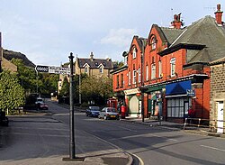
Chinley is a rural village in the north-west of Derbyshire, in the Peak, in the Blackbrook Valley, up the valley from Buxworth.
A population of 2,796 was recorded at the 2011 Census. Historically, before the coming of the railway, the area was economically dominated by agriculture. Nowadays most inhabitants commute out of the village to work in neighbouring counties: accessible centres of work include Stockport in Cheshire, Sheffield in Yorkshire and Manchester in Lancashire.
Geography
The Blackbrook Valley runs westwards, taking the brook down to the River Goyt. To the north of Chinley is Cracken Edge, a promontory once heavily quarries, at the edge of Chinley Churn, prominent hill which reaches 1,483 feet above sea level. An old winding engine can still be seen atop an incline on the north-eastern face of Cracken Edge.
The A624 road runs southwards to the dale to the east of Chinley. Brown Knoll commands the skyline on the eastern border of the parish, with South Head and Mount Famine to the north-east.
Immediately south of the village is Eccles Pike, an almost-conical hill, partly owned by the National Trust.
Filling the upper end of the valley to the southeast is Chapel-en-le-Frith, more than twice the size of Chinley in area and in population. Other nearby towns include Whaley Bridge just over the Cheshire border two miles to the west, New Mills three miles north-west), Glossop six miles north) and Buxton five miles to the south. Buxworth (in the same civil parish) is the location of Bugsworth Basin on the Peak Forest Canal.
Buxton Road to the east (bypassed here by the A6 through Whitehough) leads to the small settlement of New Smithy, beyond which the road turns south to Chapel Milton before crossing the Black Brook and continuing south into Chapel-en-le-Frith.
The boundary of the Peak District National Park runs up the middle of Stubbins Lane and part of Maynestone Road, before crossing down into the valley and over Otter Brook.
The railway
The coming of the railways was the reason Chinley grew from the tiny hamlet it had been, and the village is actually named after its railway station. Previously, the names Maynestonefield or Four Lanes End were used. Chinley railway station was once an important railway junction on the Midland Railway's Dore and Chinley (or Hope Valley) line and its London-bound extension through Millers Dale, and it was common to have to change trains in Chinley en route to Manchester, London or Sheffield. The station is now a single 'island' platform on the trans-Pennine line between Sheffield and Manchester Piccadilly. It is, however, one of the only two stations between Stockport and Sheffield where express trains stop in peak hours.
History in the buildings
Chinley Independent Chapel, on the south-eastern edge of Chinley adjacent to Chapel Milton, was built in 1711. The chapel was established by William Bagshaw as a nonconformist church in 1662, and is still the home of the local Congregational church. It has simple furnishings and a pulpit near the centre of the building.
The route of the Peak Forest Tramway (in use from 1796–1923), an early horse-and-gravity-powered railway, runs along the southern edge of Chinley near the Black Brook. The one remaining entrance to the Stodhart Tunnel, one of the oldest railway tunnels in Britain, is just inside the entrance to Chapel Lodge nursing home, on the road between Chapel Milton and Chapel-en-le-Frith (in the latter parish).[1]
Part of the tramway route is used as a road for testing car brakes by Ferodo, a local manufacturer of brakes and car parts. There are ruins or conversions of a few mills — one still in use as a plastics factory — and one or two large manor-style homes near the route.
The fine stone building of Chinley railway station was dismantled in 1902 and re-erected as a private house on Maynestone Road on the northeast edge of Chinley.
The Old Hall in the nearby hamlet of Whitehough, across the Black Brook to the south, dates from Elizabethan times and, with the adjacent 400-year-old licensed premises, forms part of the Old Hall Inn.[2] A King's Mill stood alongside the Black Brook in Chapel Milton for around 700 years, but was destroyed in 1946 to allow construction of a water treatment facility for Ferodo.
A small cattle market was developed on the south side of the railway, near the station, in the early 19th century by a local farmers' co-operative society. It was conducted by Brady & Son of Stockport, who could access it conveniently from Stockport Tiviot Dale station on the Midland Railway. It closed before the Second World War.
Society and sport
Chinley has a primary school; a small residential special school; an active village community centre and a Women's Institute hall; two village greens (one was formerly the bowling green); two parks, one of which is a local nature reserve; and a small collection of local shops.
- Junior football: Chinley Juniors Football Club (who play at Chinley Community Centre)
- Cycling: Chinley Churners
Outside links
| ("Wikimedia Commons" has material about Chinley) |
References
- ↑ National Heritage List 1334843: Stodhart Tunnel (Grade II* listing)
- ↑ National Heritage List 1187237: Old Hall Inn (Grade II listing)
