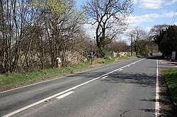
Stone, Yorkshire
| Stone | |
| Yorkshire West Riding | |
|---|---|
 The A634 in Stone | |
| Location | |
| Grid reference: | SK554894 |
| Location: | 53°24’5"N, 1°10’29"W |
| Data | |
| Post town: | Sheffield |
| Postcode: | S66 |
| Dialling code: | 01709 |
| Local Government | |
| Council: | Rotherham |
| Parliamentary constituency: |
Rother Valley |
Stone is a hamlet in the Wesr Riding of Yorkshire, in the south-east of the riding, just two miles from the border of Nottinghamshire.
The closest village of any size is Maltby to the north (to whose civil parish Stone has been allocated). A mile to the south-east is Firbeck.
Roche Abbey stands to the west of the hamlet, with Sandbeck Park to the north.
Firbeck Dike
- Main article: Firbeck Dike
The Firbeck Dike flows through the hamlet.[1]
Stone Mill, dating back to 17th century, still stands on the dike.[2]
References
- ↑ Bradley, Tom (1893) (in en). The Yorkshire Anglers' Guide to the Whole of the Fishing on the Yorkshire Rivers. T. Bradley. https://books.google.com/books?id=99ODmdlhlXkC&newbks=0&printsec=frontcover&pg=PA61&dq=firbeck+dike+stone&hl=en.
- ↑ National Heritage List 1151864: Stone Mill (Grade II listing)