Windermere


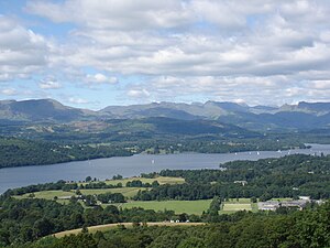
Windermere is the largest natural lake in England; over 11 miles long though under a mile wide (1,630 yards at its widest) covering an area of 5.69 square miles. Its south-eastern and western shores form much of the boundary between Westmorland and Lancashire North of the Sands. It has been one of the country’s most popular places for holidays and summer homes since 1847, when the Kendal and Windermere Railway built a branch line to it. It is entirely within the Lake District National Park.
The lake also gives its name to the town of Windermere, which sits above its eastern shore.
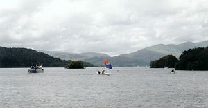
For many ages Windermere has served as a highway for waterborne transport, its barges bearing heavy loads north or south, but since the flowering of Victorian tourism it has been better known as a holiday destination and the boats seen on the mere are more likely to be for leisure than labour. The water bobs with private and public pleasure boats and on its flatter, Westmorland shore are holiday resorts. The western shore, in Lancashire, is more rugged where the Furness Fells rise up.
All of the western shoreline is owned by the National Trust, which also owns Fellfoot Park at the southern end of the lake.
Windermere is a ribbon lake believed to have been formed in a glacial trough after the retreat of ice at the start of the current interglacial. Caught among the high fells as it is, its surface is just 128 feet above sea level. Its maximum depth is 219 feet.
Name
The word "Windermere" is thought to translate as "Vinandr's lake", from the Old Norse name Vinandr and English "mere".[1] It was known as "Winander Mere" or "Winandermere" until at least the nineteenth century.[2][3]
The town of Windermere by contrast was formerly named Birthwaite, and took its current name from the railway station built there, which was in turn named after the lake.
Towns
There are two towns on the lake, Ambleside and Bowness-on-Windermere, though Ambleside is connected only by its hamlet of Waterhead. At Waterhead at the head of the lake once stood the Roman fort of Galava.
The town of Windermere does not directly touch the lake.
Landscape
Windermere is a “ribbon mere”; a long strip of water. It was formed 13,000 years ago during the last major ice age by two glaciers, one from the Troutbeck valley and the other from the Fairfield horseshoe. When the glaciers melted the lake filled with the meltwater, which was held in by moraine deposited by the glacier.
The lake is drained from its southernmost point by the River Leven.[4] It is replenished by the rivers Brathay, Rothay, Trout Beck, Cunsey Beck and several other lesser streams. The lake is largely surrounded by foothills of the Lake District which provide pleasant low-level walks; to the north and north-east are the higher fells of the central Lakeland.[4]
There is debate as to whether the stretch of water between Newby Bridge and Lakeside at the southern end of the lake should be considered part of Windermere, or a navigable stretch of the River Leven. This affects the stated length of the lake, which is 11 miles 420 yards long if measured from the bridge at Newby Bridge,[4] or 10½ miles if measured from Lakeside. The lake varies in width up to a maximum of 1,630 yards and covers an area of 5.69 square miles.[4] Its maximum depth is 219 feet and its elevation above sea level 128 feet. The lowest point of the lake bed is thus well below sea level.[4]
Islands
The lake contains 18 islands.[5] By far the largest is the privately owned Belle Isle of 40 acres lying opposite Bowness and a little over half a mile long.
The other islands are considerably smaller. The island of Lady Holme is named after the church that formerly stood there. The remaining islands are Bee Holme, Blake Holme, Crow Holme, Fir Holme, Grass Holme, Lilies of the Valley (East, and West), Ling Holme, Hawes Holme, Hen Holme, Maiden Holme (the smallest island, containing a singular tree), Ramp Holme, Rough Holme, Snake Holme, Thompson Holme (2nd largest), Silver Holme.[5]
Natural history
The lake has a very high percentage of its drainage area under cultivation (29.4%), and a relatively low percentage of lake bed above which is rocky (28%). This makes Windermere a rich habitat. The main fish in the lake are trout, char, pike, and perch.
The north to south alignment of the lake, combined with its position between Morecambe Bay and the central fells, means that it forms what is essentially a migration highway. During winter months geese flying this route are a common sight.
The Freshwater Biological Association was established on the shore of Windermere in 1929 and much of the early work on lake ecology, freshwater biology and limnology was conducted here.
Possibly with a view to drawing more of a tourist trade, sporadic reports have been made of a lake-dwelling creature named “Bownessie”, a creature described as similar to that alleged to inhabit Loch Ness in Inverness-shire. Recently mobile 'phone pictures show an undulating back appearing above the lake surface.[6]
Windermere Town
| Windermere | |
| Westmorland | |
|---|---|
 Main Road, Windermere | |
| Location | |
| Grid reference: | SD410982 |
| Location: | 54°22’34"N, 2°54’27"W |
| Data | |
| Population: | 8,245 |
| Post town: | Windermere |
| Postcode: | LA23 |
| Dialling code: | 015394 |
| Local Government | |
| Council: | Westmorland & Furness |
| Parliamentary constituency: |
Westmorland and Lonsdale |
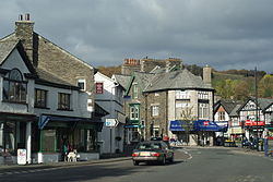
The town of Windermere lies in southern Westmorland. It is named after the lake of the same name but stands half a mile from its shore. It had a population of 8,245 at the 2001 census.
The town was originally the village of Birthwaite, but when the railway line was built in 1847 the station was named "Windermere", and so that name was attached to Birthwaite itself. Nevertheless, the town of Windermere does not reach the lakeside. Windermere town has now grown together with the older lakeside town of Bowness-on-Windermere, though the two retain distinguishable town centres.
The town has a number of museums, but the main attraction for the tourists is the lake itself that touches Bowness at the bottom of the hill (about a twenty-minute walk from the top of Windermere town). Here there is a beautiful view of the mountains. Boats from the piers in Bowness sail around the lake, many calling at Ambleside or at Lakeside, where there is a restored railway.
The geological formations around the area take their name from the town. They are called the Windermere Group of sedimentary rocks. The town's name is also given to the Rt. Hon. Dr David Clark, Baron Clark of Windermere, who now lives in Windermere.
Bibliography
- Parker, John Wilson (2004). An Atlas of the English Lakes. Cicerone Press. ISBN 1-85284-355-1.
Outside links
Lake
- Location map: 54°21’26"N, 2°56’3"W
- Photographs of Windermere
- The Cumbria Directory - Windermere
- Windermere Cruising Association
- Royal Windermere Yacht Club
- Windermere Steamboat Project
- The Windermere Way - a walking route around the lake.
- Windermere Interactive Maps - 2d & 3d
Town
- Windermere Online Windermere Online Community Website.
- UKattraction Tourist attractions in Windermere.
- The Cumbria Directory - Windermere
References
- ↑ http://web.ukonline.co.uk/sw.rae/tarns.htm Derivation of the Names of Lake District Lakes and Tarns
- ↑ "Gray's Book of Roads". George Carrington Gray. 1824. http://upload.wikimedia.org/wikipedia/commons/1/12/Gray1824.westmoreland.jpg.
- ↑ Daniel Defoe (1726). A Tour through the Whole Island of Great Britain. "I must not forget Winander Mere, which makes the utmost northern bounds of this shire..."
- ↑ 4.0 4.1 4.2 4.3 4.4 Parker, 2004, pages 22-33
- ↑ 5.0 5.1 "Windermere islands". Lake District National Park. http://www.lake-district.gov.uk/index/enjoying/windermere/windermere_outonthelake/windermere-islands.htm.
- ↑ http://www.telegraph.co.uk/news/newstopics/howaboutthat/8332535/New-photo-of-English-Nessie-hailed-as-best-yet.html