Soulby, Cumberland
| Soulby | |
| Cumberland | |
|---|---|
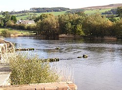
 The Eamont emerges from Ullswater at Soulby | |
| Location | |
| Grid reference: | NY462250 |
| Location: | 54°37’2"N, 2°49’59"W |
| Data | |
| Postcode: | CA11 |
| Local Government | |
| Council: | Westmorland & Furness |
| Parliamentary constituency: |
Penrith and The Border |
Soulby is a hamlet in in Cumberland spread thinly along a dead-end lane above the foot of Ullswater, where the River Eamont emerges from the lake.
The nearest village is Pooley Bridge at the foot of the lake half a mile to the south-west (and in Westmorland), while Dacre is just under a mile to the north. The hamlet runs from Souland Gate to Waterfoot, and a tiny hill, Soulby Fell rises above to the north-west.
The A592, which runs along the whole north shore of Ullswater, is just below the hamlet.
The village has a
Outside links
| ("Wikimedia Commons" has material about Soulby, Cumberland) |

