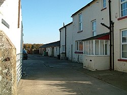
Rockcliffe Cross
| Rockcliffe Cross | |
| Cumberland | |
|---|---|
 Farm buildings, Rockcliffe Cross | |
| Location | |
| Grid reference: | NY343627 |
| Location: | 54°57’18"N, 3°1’30"W |
| Data | |
| Post town: | Carlisle |
| Postcode: | CA6 |
| Dialling code: | 01228 |
| Local Government | |
| Council: | Cumberland |
| Parliamentary constituency: |
Penrith and The Border |
Rockcliffe Cross is a village in the parish of Rockcliffe in the north of Cumberland, seven miles north of the county town, Carlisle.
The place is to be found on an unclassified road near Rockcliffe, in the land between the final, tidal meanders of both the River Eden and the River Esk, immediately inland of Rockcliffe Marsh, the tongue of tidally inundated land in the Solway Firth between the rivermouths. The bounds of Dumfriesshire are just two and a half miles to the north-west.
The M6 motorway is a few miles away (which took the course of the A74 road until it was upgraded and access to it was restricted).
Outside links
| ("Wikimedia Commons" has material about Rockcliffe Cross) |
