Wotton Underwood
| Wotton Underwood | |
| Buckinghamshire | |
|---|---|
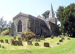
 All Saints' parish church | |
| Location | |
| Grid reference: | SP688159 |
| Location: | 51°50’16"N, 1°0’9"W |
| Data | |
| Population: | 119 (2011) |
| Post town: | Aylesbury |
| Postcode: | HP18 |
| Local Government | |
| Council: | Buckinghamshire |
| Parliamentary constituency: |
Buckingham |
Wotton Underwood is a village in Buckinghamshire, about seven miles north of Thame, which is in neighbouring Oxfordshire.
The name of the village is derived from the Old English for "farm near a wood". It is recorded in the Anglo-Saxon Chronicle for the year 848 as Wudotun and in the Domesday Book of 1086 as Oltone. The suffix "Underwood" was added later to distinguish the village from other places also called Wotton. The affix means "near the wood" and refers to the village's nearness to the ancient Bernwood Forest.[1]
The present manor house in the village, Wotton House, dates from the early eighteenth century but has been much altered since, notably by John Soane in the 1820s. The former stables, now called South Pavilion, was the former home of actor John Gielgud; it was bought by Tony and Cherie Blair for £4m, in 2008.[2]
Railways
The Brill Tramway, originally known as the Wotton Tramway and, from 1899, part of the Metropolitan Railway, which served the area, had a station named Wotton which closed in 1935 with the rest of the line.[3]
The Great Central Railway built a line from Grendon Underwood to Princes Risborough, and upon that opened a station at Wotton in 1906; this closed in 1953.[4]
Geography
The parish is on a mid-height escarpment of the outer Chiltern Hills and has an irregular shape generally bounded by headwaters. It includes a southern thin projection skirting Ashendon. Two streams rise just outside the area and flow into the south-centre from west and east and then flow north. Its relatively small area and low population itself was reduced by an enclosure act - see Wotton House. In 1821 its population reached 344 residents, which has not been exceeded since.[5] Otherwise bereft of woods and lakes, the west part has two lakes and the Warrens, an area of woodland laid out by Wooton House. The number of houses fell from 73 in 1951 to 42 ten years later.[6]
Outside links
| ("Wikimedia Commons" has material about Wotton Underwood) |
References
- ↑ Seen as Wotton Under Bernewode, in 1377; Plea Rolls of the Court of Common Pleas; CP 40/466; Edward III; 1377; last entry on File: http://aalt.law.uh.edu/AALT4/E3/CP40no466/aCP40no466fronts/IMG_0221.htm
- ↑ Jones, Sam (5 May 2008). "Blairs pay £4m for Gielgud's former home". London: The Guardian. https://www.theguardian.com/politics/2008/may/05/tonyblair. Retrieved 2008-05-06.
- ↑ Mitchell, Vic; Smith, Keith (November 2006). "Historical Background". Aylesbury to Rugby. Midland Main Lines. Midhurst: Middleton Press. ISBN 1-904474-91-8.
- ↑ Mitchell, Vic; Smith, Keith (November 2006). "figs. 61,62". Aylesbury to Rugby.
- ↑ "A Vision of Britain" Units and statistics collated by the Universidty of Portsmouth and others. Retrieved 2016-09-04
- ↑ "A Vision of Britain" Units and statistics collated by the Universidty of Portsmouth and others. Retrieved 2016-09-04
- A History of the County of Buckingham - Volume pp 130–134: {{{2}}} (Victoria County History)
- Nikolaus Pevsner: The Buildings of England: Buckinghamshire, 1960; 1994 Penguin Books ISBN 978-0-300-09584-5
