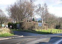
Bramley, Derbyshire
| Bramley | |
| Derbyshire | |
|---|---|
 Bramley Park. | |
| Location | |
| Grid reference: | SK408797 |
| Location: | 53°18’48"N, 1°23’18"W |
| Data | |
| Post town: | Sheffield |
| Postcode: | S21 |
| Local Government | |
Bramley is a village in Derbyshire, immediately west of Eckington (and within the latter's parish).
Bramley is within a mile of the Yorkshire border, marked by a minor stream named "The Moss", across which lie the outer suburbs of the Sheffield conurbation.

This Derbyshire article is a stub: help to improve Wikishire by building it up.