Bodesbeck Law
| Bodesbeck Law | |||
| Dumfriesshire, Selkirkshire | |||
|---|---|---|---|
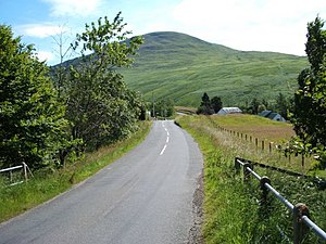
 Bodesbeck Law from Moffatdale | |||
| Range: | Ettrick Hills | ||
| Summit: | 2,173 feet NT169103 55°22’48"N, 3°18’42"W | ||
Bodesbeck Law is a mountain of 2,173 feet amongst the Ettrick Hills. Its summit is on the ridge which forms the watershed between the Tweed basin and Annandale and the border between Dumfriesshire to the west and Selkirkshire to the east.
The hill looks down over Moffatdale in Dumfriesshire, in which flows the Moffat Water down to the town of Moffat. Capel Fell (2,223 feet) stands along the ridge to the south.
The tautologously named Bodesbeck Burn, from which the hill appears to be names, runs off the west slope of Bodesbeck Law, flowing down to the Moffat Water.