Water-break-its-neck
| Water-break-its-neck | |
| Radnorshire | |
|---|---|
 Water-break-its-neck | |
| River: | unnamed stream |
| SO183600 | |
| Co-ordinates: | 52°13’57"N, 3°11’51"W |
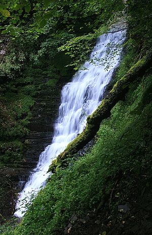
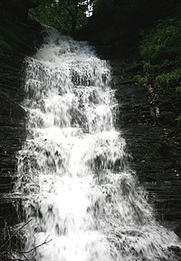
Water-break-its-neck is a tall, beautiful waterfall on an unnamed stream west in the Radnor Forest of Radnorshire. It has long been known for its remote spectacle, though reached without great effort from New Radnor.
Streams rising on the slopes of Nyth-grug unite and flow southwards down a valley on the east side of that hill, Cwm du, beginning a shallow combe and deepening until the stream turns eastward into Warren Wood. Here it plunges into a gorge, forming the waterfall.
Footpaths and a bridleway work their way up the hill slopes and beside the stream, providing a number of delightful walsk in the area. An old stone arched footbridge here has views down into the waterfall gorge.
Below the gorge the stream joins the Black Brook coming from Warren Wood which goes on the New Radnor.
Another waterfall of the same name though less well known is found on the River Lugg, also in Radnorshire.
Outside links
| ("Wikimedia Commons" has material about Water-break-its-neck) |

