An Sgarsoch
| An Sgarsoch | |||
| Aberdeenshire, Perthshire | |||
|---|---|---|---|

| |||
| Range: | Grampian Mountains | ||
| Summit: | 3,301 feet NN933836 | ||
An Sgarsoch is a mountain on the border of Aberdeenshire with Perthshire, which reaches a height of 3,301 feet at its summit, and so it qualifies as a Munro.
The name 'An Sgarsoch' means “The place of sharp rocks”.
This is a remote place and reaching it to bag this Munro involves a long trek. The approach is guarded by the need to cross water; three rivers surround it. The River Feshie and the Geldie Burn lie to the north and the River Tarf to the south.
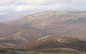
In shape, An Sgarsoch is a rounded hill and its slopes gentle up to a summit ridge which bows around a corrie, An Glas Choire, and has three main tops along it, all above 3,000 feet.
Ascents

An Sgarsoch is normally climbed together with Carn an Fhidhleir, a summit where three shires meet, the two connected by a col reaching An Sgarsoch's western ridge, which coll carries the Aberdeenshire-Perthshire border.
It takes a long walk to get to the start though. A popular route starts at Feshiebridge in the north. A mountain bike might follow the Land Rover tracks too as far as Glenfeshie Lodge. When at last the mountain is reached, the route is up the north face either of An Sgarsoch or An Fhidhleir. There are numerous bothies available hereabouts.
| Munros in SMC Area SMC Section 6 - Glen Garry to Braemar |
|---|
|
An Sgarsoch • An Socach • Beinn Dearg • Beinn Iutharn Mhòr • Beinn a' Ghlò • Càrn a' Chlamain • Carn a' Gheoidh • Càrn an Fhidhleir • Carn an Righ • Carn Aosda • Càrn Bhac • Beinn a' Ghlò • Beinn a' Ghlò • Glas Tulaichean • The Cairnwell |