Kesteven

Kesteven is one of the three parts of Lincolnshire. It is also known as Parts of Kesteven, which has never been properly explained.
Kesteven is the south-western division of the county, covering 462, 540 acres, 41 miles north to south and almost 25 miles east to west. Lindsey lies to the north and Holland to the east. Northamptonshire borders Kesteven to the south, and Rutland to the southwest, and Leicestershire and Nottinghamshire to the west.
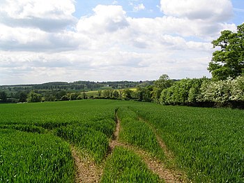
This is the more hilly part of Lincolnshire as it runs into the more central Midland shires, though pipped for ultimate height by Lindsey's Lincolnshire Wolds.
Towns and wapentakes

Kesteven contains nine wapentakes:
- Aswardhurn
- Aveland
- Beltisloe
- Boothby-Graffo
- Flaxwell
- Langoe
- Loveden
- Ness
- Winnibriggs and Threo
The main towns are Grantham and Stamford, the latter a beautiful, old town in a corner of the shire projecting between Rutland and the Soke of Peterborough, where the River Gwash marks the edge of the shire.
Grantham founded modern science and modern politics: Sir Isaac Newton was schooled here, and Margaret Thatcher born here – on her ennoblement she took the title "Baroness Thatcher of Kesteven".