Prestbury, Cheshire
| Prestbury | |
| Cheshire | |
|---|---|
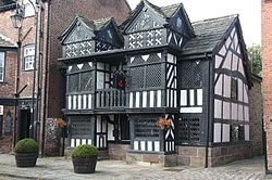
 The Priest's House, now NatWest, Prestbury | |
| Location | |
| Grid reference: | SJ904773 |
| Location: | 53°17’34"N, 2°8’43"W |
| Data | |
| Population: | 3,324 (2001) |
| Post town: | Macclesfield |
| Postcode: | SK10 |
| Dialling code: | 01625 |
| Local Government | |
| Council: | Cheshire East |
| Parliamentary constituency: |
Macclesfield |
Prestbury is a village in Cheshire. The parish of Prestbury is a long, narrow parish covering 2,879 acres to the west of the Peak Park foothills and to the east of the sandstone ridge which is ‘the edge’. The village is about a mile and a half north of Macclesfield.
At the time of the 2001 census, the civil parish had a population of 3,324.
The village is a commuter village for nearby Manchester and the towns round about, and is one of the most sought after and expensive places to live outside of London. Prestbury is a frequent winner of Best Kept Village/Community Pride Competitions, and a popular destination for sightseers.[1]
Name
The name 'Prestbury' is Old English, and may be from Preosta burh ('Priests' Town / Borough') or Preosta beorg ('Priests' Hill').
History and geography
Prestbury lies between Macclesfield and Wilmslow, for the most part on elevated ground above the flood-prone River Bollin. The ancient Forest of Macclesfield is to the east.
There is no evidence of a settlement before Anglo-Saxon times, although a cemetery nearby which had been excavated in 1808 contained pottery cremation urns and signs of sacrifice and was presumably pre-Christian.
The parish
At the time of the Norman conquest, the parish consisted of thirty-five townships:
|
|
|
|
|
Prestbury township was not mentioned in the Domesday Book, perhaps because information was not supplied or because Prestbury was only a church, not a manor.

Twelve of the other townships are mentioned. Butley was valued at 2 shillings at the time of the Domesday Survey, compared with 30 shillings at the time of Edward the Confessor, Adlington and Macclesfield were both worth 20 shillings and Siddington 5 shillings. The other eight townships were valued "Waste".
The church administered the civil as well as ecclesiastical affairs of the parish until the Local Government Act 1894 created rural districts and civil parishes. Three of the townships, Butley, Fallibroome and Prestbury, constitute the present civil parish of Prestbury.
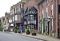
The school, smithies, the mill, inns and the stocks centre on a village street called "The Village", which is broad enough for cattle fairs and the like. Until the 19th century the village street was connected to Pearl Street, the main street of Butley, by a ford.
In about 1825, a bridge of two arches was built, linking the village street to a new road ("New Road") passing behind the cottages and the Admiral Rodney pub[2] on the southeast side of Pearl Street. In 1855 the bridge was replaced by the present bridge with one arch.[3]
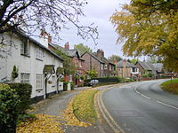
During the 19th century Prestbury became involved in the silk industry. Swanwick's factory operated and cottages were built for the workers ("Factory Cottages" or "Irish Row"). Weavers' cottages were built on both New Road and the Village[4] with upper storeys for weaving.
In the 20th century, improved communications made it possible for Prestbury to develop into a residential community.
Prestbury Mill[5] was destroyed by fire in 1940.
The village

The Conservation Area includes areas neighbouring the village street, the east side of Macclesfield Road as far south as the Methodist Church,[6] and New Road as far north as Butley Cottage[7] and its garden.

Many of the buildings and structures in the Conservation Area are listed by English Heritage, four of them, Bridge Hotel,[8] Priest's House,[9] Horner's[10] and Prestbury Hall[11] being regarded as "Focal Buildings". Other buildings are considered to be of townscape merit. Trees and even some hedges are important landscape features.
The Manor House[12] was shown as the vicarage on the 1831 map.
Brooks Cottages,[13] marked with a plaque reading "Rodger Brooks and Ellen his wife erected this house in the 24 years of his life Ano Dom 1686" are among the listed buildings on the Butley side of the Bollin.
Other areas
Smithy Cottage, built on the site of a former smithy, is just outside the conservation area.
Butley Hall[14] is shown on the 1831 map but is outside the Conservation area, as are the Butley Ash Inn and Spittle House, which was probably built between 1300 and 1450 as a leper hospital.
New estates were built during the 20th century to accommodate commuters.
The defining characteristic of 21st century development has been the replacement of quite sizeable houses by large mansions, such as that built for Wayne Rooney.[15]
Adlington Hall[16] with strong connections with Prestbury is nearby.
Suburban Development
Since the 1970s, there has been new build development in the village. Packsaddle Park is a good example of this. It is a suburban development built on the grounds of Packsaddle House. In addition to this, there has been a lot of redevelopment of existing houses in the village.
Churches
- Church of England:
- Methodist: Prestbury Methodist Church
Sporting facilities
- Badminton club
- Bowling club
- Cricket club
- Football clubs
- Golf: Prestbury Golf Club, accessed 2 December 2007</ref>
- Rugby: Macclesfield Rugby Club
- Riding school
- Squash rackets club
- Tennis: Prestbury Tennis Club
The village has a Queen Elizabeth II Field.
Outside links
| ("Wikimedia Commons" has material about Prestbury, Cheshire) |
- prestbury.com Local news and information
- Prestbury Parish Council Official website
- Plan for Prestbury
- All about Prestbury, past, present and future
- Oliver Wood's photos A collection of photos of Prestbury and the surrounding area.
- Travel article "The Wilmslow Boys" by A.A.Gill. Prestbury slated as "Smug Central"
References
- ↑ Photos at Boots and Paws, accessed 24 October 2007
- ↑ Images of England — details from listed building database (58362) The Admiral Rodney
- ↑ Prestbury Cheshire Website, accessed 20 October 2007
- ↑ English Heritage: Images of England, accessed 25 October 2007
- ↑ Prestbury Cheshire – The Corn Mill
- ↑ Prestbury Cheshire website, accessed 20 October 2007
- ↑ Prestbury Cheshire website, accessed 20 October 2007
- ↑ IoE|413841|Bridge House}}
- ↑ {IoE|58372|Priest's House}}
- ↑ Images of England — details from listed building database (58368) Horner's
- ↑ IoE|413829|Prestbury Hall}}
- ↑ Images of England — details from listed building database (58374) The Manor House, Prestbury
- ↑ Images of England — details from listed building database (58365) Brooks Cottages, Prestbury
- ↑ Images of England — details from listed building database (58367) Butley Hall
- ↑ The Independent, accessed 14 February 2008
- ↑ Images of England — details from listed building database (58181) Adlington Hall
- ↑ Images of England — details from listed building database (413837) St Peter's, Prestbury
- ↑ St. Peter's Church
- ↑ Prestbury Cheshire
- A. J. S. Cartmell "The History of Prestbury", St.Peter's Church, Prestbury, 2006
- Gordon B. Hindle "St. Peter's Prestbury: a personal response", Church of St. Peter, Prestbury, Cheshire, 2001
- Hunter, W.W. (1896). Life of Brian Houghton Hodgson. London: John Murray. http://www.archive.org/details/lifebrianhoughto035100mbp.
- Prestbury Community Directory, Prestbury Parish Council, 2008
- Prestbury Conservation Area Appraisal: Draft for Public Consultation: Macclesfield Borough Council, January 2006, accessed 28 October 2007
- Prestbury Village Design Statement: Supplementary Planning Document, Borough of Macclesfield, June 2007, accessed 28 October 2007
- Frank Renaud "Contributions towards a history of the ancient Parish of Prestbury in Cheshire", the Chetham Society, 1876
- Village Design Statement for Prestbury Parish, accessed 15 April 2008
