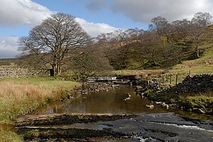
Clough River

The Clough River is a tributary of River Rawthey in the West Riding of Yorkshire. Its course is 11 miles long, all in the very west of the county, west of the Pennine watershed.
The river carves a deep dale through the Pennine Fells, known as Garsdale.[1]
Course
The river begins from the numberless becks or 'gills' running off the north slopes of Baugh Fell (2,224 feet) in the north-west of the West Riding: just yards from the uttermost of these gills the River Rawthey's headwaters begin too, running off the slope beside the Clough's but then in the opposite direction. The gathered waters form the Grisedale Beck beneath the fell, then fetch a clockwise compass about Baugh Fell, taking in let more streams off its flanks as it goes.
The Grisedale Beck runs south-eastwards through a short dale known as Grisedale and over a waterfall before first being named 'Clough' at Clough Farm, at Garsdale Head. Here the waters enter Garsdale, curving to the south-west and then the north-west, between Baugh Fell to the north and Rise Hill to the south.[1]
The Clough is mainly shallow and rocky, with occasional pools large enough for swimming, though the water is always cold. The A684 (Northallerton to Kendal) road follows the river for seven miles with frequent bridges in the upper part of the dale. At Longstone Fell the main (former turnpike) road rises to a well-known view-point looking over the Howgill Fells, and the river descends to Danny Bridge, the site of a seventeenth-century mill on the "old road".
The Clough discharges into the River Rawthey at Dowbiggin Foot above Sedbergh.
About the river
The Clough River runs through the Yorkshire Dales National Park.
In 1985 a geological walk, the Sedgwick Trail, named after the well-known geologist Adam Sedgwick (1785-1873), was opened. It runs along the Clough from Danny Bridge and highlights rock features along the Dent Fault.
Outside links
| ("Wikimedia Commons" has material about Clough River) |
- Location map: 54°19’0"N, 2°28’60"W
References
- ↑ 1.0 1.1 Catchment Data Explorer: Clough River - Environment Agency
