Template:FP-Moel Sych: Difference between revisions
Jump to navigation
Jump to search
No edit summary |
No edit summary |
||
| Line 6: | Line 6: | ||
The summit of Moel Sych stands at 2,726 feet above sea level and it was for many years held to be the highest point of the Berwyns and consequently of Denbighshire and of Montgomeryshire. In latter years though a fell walker found a summit between those of Moel Sych and Cadair Berwyn ten feet higher than either, which demoted Moel Sych, although leaving it as Montgomeryshire's county top. | The summit of Moel Sych stands at 2,726 feet above sea level and it was for many years held to be the highest point of the Berwyns and consequently of Denbighshire and of Montgomeryshire. In latter years though a fell walker found a summit between those of Moel Sych and Cadair Berwyn ten feet higher than either, which demoted Moel Sych, although leaving it as Montgomeryshire's county top. | ||
The name Moel Sych is Welsh, meaning "Dry Hill"; a good description of this wind-scoured summit.}}<noinclude> | The name Moel Sych is Welsh, meaning "Dry Hill"; a good description of this wind-scoured summit.}}<noinclude>{{FP data}} | ||
Latest revision as of 08:36, 8 May 2021
 |
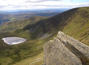
Moel SychMoel Sych is a mountain top on the ridge of the Berwyn Range, whose summit is the point where three shires meet: Denbighshire, Merionethshire and Montgomeryshire. The summit of Moel Sych stands at 2,726 feet above sea level and it was for many years held to be the highest point of the Berwyns and consequently of Denbighshire and of Montgomeryshire. In latter years though a fell walker found a summit between those of Moel Sych and Cadair Berwyn ten feet higher than either, which demoted Moel Sych, although leaving it as Montgomeryshire's county top. The name Moel Sych is Welsh, meaning "Dry Hill"; a good description of this wind-scoured summit. (Read more) |