Vale of Rheidol Railway: Difference between revisions
m clean up, typos fixed: 4 wheeled → 4-wheeled |
No edit summary |
||
| Line 14: | Line 14: | ||
|gauge=23.75" | |gauge=23.75" | ||
}} | }} | ||
The '''Vale of Rheidol Railway''' is a | The '''Vale of Rheidol Railway''' is a 23¾-inch narrow gauge heritage railway that runs for 11¾ miles between [[Aberystwyth]] and [[Devil's Bridge]] in [[Cardiganshire]].<ref>Johnson 1999, page 15</ref> | ||
Until privatisation, the line was the sole steam-operated line on the nationalised British Rail network, steam traction having ceased in 1968 on all other parts of the system. | Until privatisation, the line was the sole steam-operated line on the nationalised British Rail network, steam traction having ceased in 1968 on all other parts of the system. | ||
| Line 23: | Line 23: | ||
A narrow gauge railway in the area of Aberystwyth was first proposed after the initial route planned for the Manchester and Milford Railway, from [[Llanidloes]] to [[Aberystwyth]] by way of [[Devil's Bridge]], was altered, and then abandoned, before construction started.<ref>Johnson 2011, page 52</ref> | A narrow gauge railway in the area of Aberystwyth was first proposed after the initial route planned for the Manchester and Milford Railway, from [[Llanidloes]] to [[Aberystwyth]] by way of [[Devil's Bridge]], was altered, and then abandoned, before construction started.<ref>Johnson 2011, page 52</ref> | ||
The original primary purpose of the line was to carry timber and ore from the [[River Rheidol|Rheidol Valley]] to the sea and the main line railway at Aberystwyth. Many lead mines in the valley were producing ore at the end of the 19th century. Construction began in 1901 following an Act of Parliament in 1897. Rock was hand-hewn instead of being blasted, in order to save money. | The original primary purpose of the line was to carry timber and ore from the [[River Rheidol|Rheidol Valley]] to the sea and the main-line railway at Aberystwyth. Many lead mines in the valley were producing ore at the end of the 19th century. Construction began in 1901 following an Act of Parliament in 1897. Rock was hand-hewn instead of being blasted, in order to save money. | ||
By the time the railway was ready to open in 1902, lead mining in Cardiganshire was in steep decline. However a significant growth in tourism was under way, and the carriage of passengers soon became the principal traffic of the railway. It opened for mineral traffic in August 1902 and for passengers on 22 December 1902. | By the time the railway was ready to open in 1902, lead mining in Cardiganshire was in steep decline. However a significant growth in tourism was under way, and the carriage of passengers soon became the principal traffic of the railway. It opened for mineral traffic in August 1902 and for passengers on 22 December 1902. | ||
| Line 35: | Line 35: | ||
The Great Western Railway became part of the Western Region of British Railways on 1 January 1948 and the line continued to operate a tourist service.<ref>Green 1986, page 29</ref> | The Great Western Railway became part of the Western Region of British Railways on 1 January 1948 and the line continued to operate a tourist service.<ref>Green 1986, page 29</ref> | ||
In 1968, the line was rerouted in Aberystwyth to run adjacent to the BR line into the former standard gauge Carmarthen line platforms of the main station which had been abandoned in 1964. The former standard gauge locomotive shed was also refurbished and adapted into use for this railway.<ref>Johnson 2011, page 88</ref> The former station site is now occupied by a supermarket and the former route of this alignment has been sold for redevelopment. | In 1968, the line was rerouted in Aberystwyth to run adjacent to the BR line into the former standard-gauge Carmarthen line platforms of the main station which had been abandoned in 1964. The former standard-gauge locomotive shed was also refurbished and adapted into use for this railway.<ref>Johnson 2011, page 88</ref> The former station site is now occupied by a supermarket and the former route of this alignment has been sold for redevelopment. | ||
===Privatisation=== | ===Privatisation=== | ||
The line was privatised in 1989, sold to Peter Rampton and Tony Hills ( | The line was privatised in 1989, sold to Peter Rampton and Tony Hills (later owner and General Manager of the [[Brecon Mountain Railway]]).<ref>"The Great British Rail Sale is Over" ''The Railway Magazine'' issue 1152 April 1997 pages 24/25</ref> In 1996, Rampton and Hills split their partnership, with Hills retaining control of the Brecon, and the Rheidol being sold to a trust formed by Rampton, the Phyllis Rampton Narrow Gauge Railway Trust.<ref>{{cite journal|last=Boyd-Hope|first=Gary|title=Rheidol revival: 20 years of private enterprise|journal=Steam Railway|volume=358|date=January 2009|pages=91–5}}</ref> | ||
==The railway today== | ==The railway today== | ||
| Line 55: | Line 55: | ||
{| class="wikitable" | {| class="wikitable" | ||
|- | |- | ||
| [[Aberystwyth]] Station || [[File:Aberystwyth Railway Station - geograph.org.uk - 606005.jpg|200px]] || {{wmap|52.41114|-4.07909}} || The headquarters of the railway, sharing a terminus with the standard gauge main line trains | | [[Aberystwyth]] Station || [[File:Aberystwyth Railway Station - geograph.org.uk - 606005.jpg|200px]] || {{wmap|52.41114|-4.07909|zoom=14|name=Aberystwyth station}} || The headquarters of the railway, sharing a terminus with the standard gauge main line trains | ||
|- | |- | ||
|''Various Sheds'' || || {{wmap|52.411523|-4.078558}} || | |''Various Sheds'' || || {{wmap|52.411523|-4.078558|zoom=14|name=Sheds}} || | ||
|- | |- | ||
| Llanbadarn Station || [[File:Llanbadarn(1).jpg|150px]] || {{wmap|52.405652|-4.061069}} || A request stop serving the village of [[Llanbadarn Fawr]]. There are no surfaced platforms or buildings. | | Llanbadarn Station || [[File:Llanbadarn(1).jpg|150px]] || {{wmap|52.405652|-4.061069|zoom=14|name=Llanbadarn station}} || A request stop serving the village of [[Llanbadarn Fawr, Cardiganshire|Llanbadarn Fawr]]. There are no surfaced platforms or buildings. | ||
|- | |- | ||
|''over [[River Rheidol]]'' || || || | |''over [[River Rheidol]]'' || || || | ||
| Line 65: | Line 65: | ||
| ''crossing'' || || || | | ''crossing'' || || || | ||
|- | |- | ||
| | | Glanyrafon Halt || [[File:Glanyrafon Station - geograph.org.uk - 769086.jpg|150px]] || {{wmap|52.404509|-4.037029|zoom=14|name=Glanyrafon halt}} || A request stop serving the nearby industrial estate. There are no surfaced platforms or buildings. | ||
|- | |- | ||
|''crossing'' || || || | |''crossing'' || || || | ||
|- | |- | ||
| Capel Bangor Station || [[File:Capel Bangor Station view.jpeg|150px]] || {{wmap|52.399358|-3.989093}} || Close to the village of Capel Bangor. New platforms and a station building (a replica of the original) were built in 2012 | | Capel Bangor Station || [[File:Capel Bangor Station view.jpeg|150px]] || {{wmap|52.399358|-3.989093|zoom=14|name=Cape Bangor station}} || Close to the village of Capel Bangor. New platforms and a station building (a replica of the original) were built in 2012 | ||
|- | |- | ||
|''crossing'' || || || | |''crossing'' || || || | ||
| Line 75: | Line 75: | ||
| Nantyronen Station || [[File:Nantyronen railway station platform.jpeg|150px]] || || A request stop. Up trains pause briefly here to allow the locomotive to take on water. New platform and station building completed in 2013. | | Nantyronen Station || [[File:Nantyronen railway station platform.jpeg|150px]] || || A request stop. Up trains pause briefly here to allow the locomotive to take on water. New platform and station building completed in 2013. | ||
|- | |- | ||
| Aberffrwd Station || [[File:Aberffrwd railway station water tower.jpg|150px]] || {{wmap|52.390650|-3.930943}} || Close to the hamlet of Aberffrwd. New platform and station building completed in 2013. | | Aberffrwd Station || [[File:Aberffrwd railway station water tower.jpg|150px]] || {{wmap|52.390650|-3.930943|zoom=14|name=Aberffrwd station}} || Close to the hamlet of Aberffrwd. New platform and station building completed in 2013. | ||
|- | |- | ||
| Rhiedol Falls Station || [[File:Rheidol Falls railway station VOR.jpeg|150px]] || {{wmap|52.391711|-3.900365}} || A request stop. New platform and station building completed in 2013. | | Rhiedol Falls Station || [[File:Rheidol Falls railway station VOR.jpeg|150px]] || {{wmap|52.391711|-3.900365|zoom=14|name=Rhiedol Falls station}} || A request stop. New platform and station building completed in 2013. | ||
|- | |- | ||
| Rhiwfron Station || [[File:Rhiwfron railway station VOR.jpeg|150px]] || {{wmap|52.383447|-3.868157}} || A request stop. New platform and station building completed in 2013. | | Rhiwfron Station || [[File:Rhiwfron railway station VOR.jpeg|150px]] || {{wmap|52.383447|-3.868157|zoom=14|name=Rhiwfron station}} || A request stop. New platform and station building completed in 2013. | ||
|- | |- | ||
| [[Devil's Bridge]] || [[File:Devils Bridge Station.JPG|200px]] || {{wmap|52.376099|-3.854789}} || the railway's eastern terminus. It is a short walk from the [[Mynach Falls|Mynach Waterfalls]]. | | [[Devil's Bridge]] || [[File:Devils Bridge Station.JPG|200px]] || {{wmap|52.376099|-3.854789|zoom=14|name=Devil's Bridge station}} || the railway's eastern terminus. It is a short walk from the [[Mynach Falls|Mynach Waterfalls]]. | ||
|} | |} | ||
Latest revision as of 19:05, 18 June 2018
| Vale of Rheidol Railway Welsh: Rheilffordd Cwm Rheidol | |
|
Cardiganshire | |
|---|---|
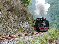 Llywelyn climbing to Devil's Bridge | |
| Gauge: | 23.75" |
| Location: | 52°24’40"N, 4°4’45"W |
| No. of stations: | 4 stations 5 halts |
| Track: | 11¾ miles |
| Information | |
| Operated by: | Vale of Rheidol Railway Limited |
The Vale of Rheidol Railway is a 23¾-inch narrow gauge heritage railway that runs for 11¾ miles between Aberystwyth and Devil's Bridge in Cardiganshire.[1]
Until privatisation, the line was the sole steam-operated line on the nationalised British Rail network, steam traction having ceased in 1968 on all other parts of the system.
Unlike other railways in the United Kingdom, the Vale of Rheidol Railway has never closed, with the exception of wartime and has operated a service for tourists through its life. The railway celebrated its centenary in 2002.
History
A narrow gauge railway in the area of Aberystwyth was first proposed after the initial route planned for the Manchester and Milford Railway, from Llanidloes to Aberystwyth by way of Devil's Bridge, was altered, and then abandoned, before construction started.[2]
The original primary purpose of the line was to carry timber and ore from the Rheidol Valley to the sea and the main-line railway at Aberystwyth. Many lead mines in the valley were producing ore at the end of the 19th century. Construction began in 1901 following an Act of Parliament in 1897. Rock was hand-hewn instead of being blasted, in order to save money.
By the time the railway was ready to open in 1902, lead mining in Cardiganshire was in steep decline. However a significant growth in tourism was under way, and the carriage of passengers soon became the principal traffic of the railway. It opened for mineral traffic in August 1902 and for passengers on 22 December 1902.
Branch line
The line lost its independence when it was absorbed by the Cambrian Railways on 1 July 1913,[3] however the onset of war in 1914 prevented major improvements being carried out.[4] Passenger services were cut back however and the need for timber for the war effort meant that freight became the principal revenue source for a short while.[5]
On 1 January 1922, it was grouped into the Great Western Railway (GWR).[6] The GWR turned it into a service solely for tourists, freight services being withdrawn, and from 1931 trains only operated during the summer months. The entire line was closed for the duration of Second World War, though maintenance continued. The railway re-opened in 1945.
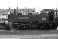
The Great Western Railway became part of the Western Region of British Railways on 1 January 1948 and the line continued to operate a tourist service.[7]
In 1968, the line was rerouted in Aberystwyth to run adjacent to the BR line into the former standard-gauge Carmarthen line platforms of the main station which had been abandoned in 1964. The former standard-gauge locomotive shed was also refurbished and adapted into use for this railway.[8] The former station site is now occupied by a supermarket and the former route of this alignment has been sold for redevelopment.
Privatisation
The line was privatised in 1989, sold to Peter Rampton and Tony Hills (later owner and General Manager of the Brecon Mountain Railway).[9] In 1996, Rampton and Hills split their partnership, with Hills retaining control of the Brecon, and the Rheidol being sold to a trust formed by Rampton, the Phyllis Rampton Narrow Gauge Railway Trust.[10]
The railway today
The railway continues to operate as a tourist railway, generally operating between Easter and the end of October with extra services during February Half Term and Santa Specials at Christmas.
There are various developments planned to enhance the facilities and visitor experience. In 2010 work started at Aberystwyth on construction of a new locomotive and carriage works.
Rheidol Explorer
The railway has developed the Rheidol Explorer audio tour was developed during 2011 and uses GPS handsets to provide passengers with a commentary during the journey.
The route
There are nine stations. Whilst all trains generally stop at block stations, for operational reasons, the other intermediate stations are treated as request stops. The journey takes one hour in each direction and much of it at a gradient of 1 in 50.
| Aberystwyth Station | 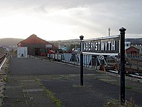 |
52°24’40"N, 4°4’45"W | The headquarters of the railway, sharing a terminus with the standard gauge main line trains |
| Various Sheds | 52°24’41"N, 4°4’43"W | ||
| Llanbadarn Station | 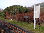 |
52°24’20"N, 4°3’40"W | A request stop serving the village of Llanbadarn Fawr. There are no surfaced platforms or buildings. |
| over River Rheidol | |||
| crossing | |||
| Glanyrafon Halt | 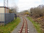 |
52°24’16"N, 4°2’13"W | A request stop serving the nearby industrial estate. There are no surfaced platforms or buildings. |
| crossing | |||
| Capel Bangor Station | 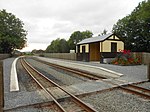 |
52°23’58"N, 3°59’21"W | Close to the village of Capel Bangor. New platforms and a station building (a replica of the original) were built in 2012 |
| crossing | |||
| Nantyronen Station | 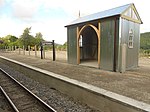 |
A request stop. Up trains pause briefly here to allow the locomotive to take on water. New platform and station building completed in 2013. | |
| Aberffrwd Station | 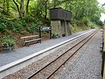 |
52°23’26"N, 3°55’51"W | Close to the hamlet of Aberffrwd. New platform and station building completed in 2013. |
| Rhiedol Falls Station | 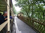 |
52°23’30"N, 3°54’1"W | A request stop. New platform and station building completed in 2013. |
| Rhiwfron Station | 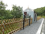 |
52°23’0"N, 3°52’5"W | A request stop. New platform and station building completed in 2013. |
| Devil's Bridge | 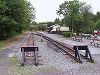 |
52°22’34"N, 3°51’17"W | the railway's eastern terminus. It is a short walk from the Mynach Waterfalls. |
When the lead mines were being worked there was an aerial cableway linking them with Rhiwfron.
The railway had a branch line which ran to Aberystwyth Harbour, principally for freight services. The Harbour Branch became redundant with the predominance of tourist passenger operations and was closed and lifted. Little evidence of it remains today.
Operation
The line has three steam locomotives for passenger trains and one diesel locomotive. The railway also owns 16 carriages and a 4-wheeled brake van.
The railway is single track with passing loops at Capel Bangor and Aberffrwd which are operated by the train crew. The line is worked by tokens, which authorise the driver to enter a single line section. Tokens are provided for:
- Aberystwyth to Capel Bangor
- Capel Bangor to Aberffrwd
- Aberffrwd to Devil's Bridge
The Duty Officer regulates train running, giving permission for trains to enter the single line sections, recording train movements on the Train Graph and ensuring trains are formed of an appropriate number of carriages.
Pictures
-
No 8 (like sister engines 7 and 9)
-
Train with No 7 leaving Aberystwyth station
-
No. 9 Prince of Wales at Devil's Bridge
-
Front view of No. 9 at Devil's Bridge
Outside links
| ("Wikimedia Commons" has material about Vale of Rheidol Railway) |
References
- ↑ Johnson 1999, page 15
- ↑ Johnson 2011, page 52
- ↑ Green 1986, page 26
- ↑ Green 1986, page 28
- ↑ Green 1986, page 28
- ↑ Green 1986, page 28
- ↑ Green 1986, page 29
- ↑ Johnson 2011, page 88
- ↑ "The Great British Rail Sale is Over" The Railway Magazine issue 1152 April 1997 pages 24/25
- ↑ Boyd-Hope, Gary (January 2009). "Rheidol revival: 20 years of private enterprise". Steam Railway 358: 91–5.
Books
- Green, CC (1986). The Vale of Rheidol Light Railway. Wild Swan. ISBN 0-906867-43-6.
- Johnson, Peter (1999). Welsh Narrow Gauge: a view from the past. Ian Allan Publishing. ISBN 0-7110-2654-8.
- Johnson, Peter (2011). An Illustrated History of the Great Western Narrow Gauge. OPC. ISBN 978-0-86093-636-7.


