Carnbo: Difference between revisions
Jump to navigation
Jump to search
No edit summary |
No edit summary |
||
| Line 16: | Line 16: | ||
| dialling code=01577 | | dialling code=01577 | ||
}} | }} | ||
'''Carnbo''' is a village in the parish of [[Fossoway]], [[Kinross-shire]], on South Queich Water, adjacent to the | '''Carnbo''' is a village in the parish of [[Fossoway]], [[Kinross-shire]], on South Queich Water, adjacent to the border with [[Perthshire]], 4½ miles west of the [[county town]], [[Kinross]]. | ||
The village is situated on the A91 trunk road that runs from [[Stirling]] to [[St Andrews]], two miles west of [[Milnathort]]. The schoolhouse at the western end of the village was once a tollhouse for the main road. | |||
[[File:Carnbo Hall - geograph.org.uk - 278052.jpg|thumb|left|Carnbo Hall: The former primary school at Carnbo, now the village hall]] | [[File:Carnbo Hall - geograph.org.uk - 278052.jpg|thumb|left|Carnbo Hall: The former primary school at Carnbo, now the village hall]] | ||
{{stub}} | {{stub}} | ||
Latest revision as of 08:08, 10 April 2018
| Carnbo | |
| Kinross-shire | |
|---|---|

| |
| Location | |
| Location: | 56°12’43"N, 3°31’34"W |
| Data | |
| Post town: | Kinross |
| Postcode: | KY13 |
| Dialling code: | 01577 |
| Local Government | |
| Council: | Perth and Kinross |
| Parliamentary constituency: |
Ochil and South Perthshire |
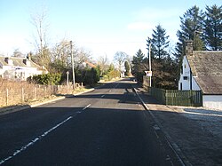
Carnbo is a village in the parish of Fossoway, Kinross-shire, on South Queich Water, adjacent to the border with Perthshire, 4½ miles west of the county town, Kinross.
The village is situated on the A91 trunk road that runs from Stirling to St Andrews, two miles west of Milnathort. The schoolhouse at the western end of the village was once a tollhouse for the main road.

This Kinross-shire article is a stub: help to improve Wikishire by building it up.