St John's Beck: Difference between revisions
Jump to navigation
Jump to search
Created page with 'right|thumb|350px|Packhorse bridge over St John's Beck {{#vardefine:shire|Cumberland}} '''St John's…' |
mNo edit summary |
||
| Line 1: | Line 1: | ||
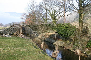
[[File:Packhorse Bridge St John's in the Vale - geograph.org.uk - 116532.jpg|right|thumb|350px|Packhorse bridge over St John's Beck]] | [[File:Packhorse Bridge St John's in the Vale - geograph.org.uk - 116532.jpg|right|thumb|350px|Packhorse bridge over St John's Beck]] | ||
{{#vardefine:shire|Cumberland}} | {{#vardefine:shire|Cumberland}} | ||
'''St John's Beck''' is a river in | '''St John's Beck''' is a river in [[Cumberland]], within the [[Lake District]]. | ||
The beck has its beginning as an outflow of [[Thirlmere]], whence it flows northwards under the A591 then through [[St John's in the Vale]], towards [[Threlkeld]], where it meets the [[River Glenderamackin]] to form the [[River Greta]], upriver from [[Keswick]]. | The beck has its beginning as an outflow of [[Thirlmere]], whence it flows northwards under the A591 then through [[St John's in the Vale]], towards [[Threlkeld]], where it meets the [[River Glenderamackin]] to form the [[River Greta]], upriver from [[Keswick]]. | ||
Revision as of 06:39, 24 June 2013

St John's Beck is a river in Cumberland, within the Lake District.
The beck has its beginning as an outflow of Thirlmere, whence it flows northwards under the A591 then through St John's in the Vale, towards Threlkeld, where it meets the River Glenderamackin to form the River Greta, upriver from Keswick.
The B5322 Legburthwaite to Threkeld road follows the beck down. To the east rises the high bulk of Matterdale Common, and to the west is a lower ridge separating the dale from the Naddle Beck and beyond it Keswick and Derwent Water.
Coordinates: 54°36′45″N 3°03′46″W / 54.6125°N 3.0627°W