Ridge, Hertfordshire: Difference between revisions
Jump to navigation
Jump to search
Created page with 'Ridge, Hertfordshire {{Infobox town |name=Ridge |county=Hertfordshire |picture=St Margaret, Ridge, Herts - geograph.org.uk - 348807.jpg |picture caption=St Margaret, Ridge |os g…' |
mNo edit summary |
||
| Line 1: | Line 1: | ||
{{Infobox town | {{Infobox town | ||
|name=Ridge | |name=Ridge | ||
Latest revision as of 23:04, 4 November 2012
| Ridge | |
| Hertfordshire | |
|---|---|
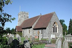
 St Margaret, Ridge | |
| Location | |
| Grid reference: | TL215005 |
| Location: | 51°41’24"N, 0°14’37"W |
| Data | |
| Postcode: | EN6 |
| Local Government | |
| Council: | Hertsmere |
Ridge is a village in southern Hertfordshire, found between Potters Bar (Middlesex) and Shenley, Hertfordshire. It lies right against the border with Middlesex: after the last house in the main body of the village the lane enters the latter shire on the way to South Mimms.
Ridge has a small church, St Margaret's, and a small playground. There is a public house called the Old Guinea which serves food on most days.
The village holds a fete day on the August bank holiday which welcomes visitors. Ridge is surrounded by countryside with public footpaths for country walks.
Outside links
| ("Wikimedia Commons" has material about Ridge, Hertfordshire) |
