Broad Law: Difference between revisions
No edit summary |
mNo edit summary |
||
| Line 2: | Line 2: | ||
|name=Broad Law | |name=Broad Law | ||
|county=Peeblesshire | |county=Peeblesshire | ||
|range= | |range=Manor Hills | ||
|picture=Broad Law.jpg | |picture=Broad Law.jpg | ||
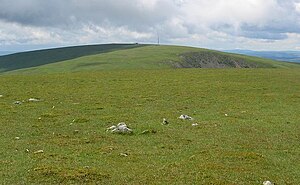
|picture caption=Broad Law, seen from Cramalt Craig | |picture caption=Broad Law, seen from Cramalt Craig | ||
| Line 8: | Line 8: | ||
|os grid ref=NT146235 | |os grid ref=NT146235 | ||
}} | }} | ||
'''Broad Law''' stands within [[Peeblesshire]] and at 2,756 feet it is the [[county top]]. It is the second-highest hill in the whole of the | '''Broad Law''' stands within [[Peeblesshire]] and at 2,756 feet it is the [[county top]]. It is within the [[Manor Hills]], part of the [[Southern Uplands]], and is the second-highest hill in the whole of the Southern Uplands, overtopped only by [[Merrick]] in [[Kirkcudbrightshire]], and is only ten feet lower than Merrick. Broad Law is the highest hill for 30 miles in all directions. | ||
Like many of its neighbours, Broad Law is smooth, rounded and grassy, although the surrounding valleys have very steep sides, which is country somewhat akin to the [[Cheviots]] or the [[Howgill Fells]]. | Like many of its neighbours, Broad Law is smooth, rounded and grassy, although the surrounding valleys have very steep sides, which is country somewhat akin to the [[Cheviots]] or the [[Howgill Fells]]. | ||
Revision as of 16:20, 27 August 2012
| Broad Law | |||
| Peeblesshire | |||
|---|---|---|---|
 Broad Law, seen from Cramalt Craig | |||
| Range: | Manor Hills | ||
| Summit: | 2,756 feet NT146235 | ||
Broad Law stands within Peeblesshire and at 2,756 feet it is the county top. It is within the Manor Hills, part of the Southern Uplands, and is the second-highest hill in the whole of the Southern Uplands, overtopped only by Merrick in Kirkcudbrightshire, and is only ten feet lower than Merrick. Broad Law is the highest hill for 30 miles in all directions.
Like many of its neighbours, Broad Law is smooth, rounded and grassy, although the surrounding valleys have very steep sides, which is country somewhat akin to the Cheviots or the Howgill Fells.
The hill may be climbed from any of the villages near its base, or as part of a long, 30-mile trek across the local area between the towns of Peebles and Moffat.
There is a radio tower and a VOR beacon on the summit; one of the highest of such sites in Britain.