Blackcraig Hill, Ayrshire: Difference between revisions
Jump to navigation
Jump to search
Created page with "{{Infobox hill |name=Blackcraig Hill |county=Ayrshire |range=Carsphairn Hills |picture=New Bridge over the Afton Water - geograph.org.uk - 1091060.jpg |picture caption=Blackcr..." |
No edit summary |
||
| Line 7: | Line 7: | ||
|os grid ref=NS647064 | |os grid ref=NS647064 | ||
|height=2,297 feet | |height=2,297 feet | ||
|latitude=55.332975 | |||
|longitude=-4.134459 | |||
}} | }} | ||
'''Blackcraig Hill''' is a mountain in the [[Carsphairn Hills]] in the south of [[Ayrshire]]. It rises to a summit at 2,297 feet. | '''Blackcraig Hill''' is a mountain in the [[Carsphairn Hills]] in the south of [[Ayrshire]]. It rises to a summit at 2,297 feet. | ||
From the slopes of Blackcraig Hill and neighbouring [[Blacklorg Hill]] (2,234 feet, to the south on the border with Dumfriesshire) rise many of the burns which feed the [[River Nith]] | From the slopes of Blackcraig Hill and neighbouring [[Blacklorg Hill]] (2,234 feet, to the south on the border with [[Dumfriesshire]]) rise many of the burns which feed the [[River Nith]]: amongst them the [[Kello Water]] to the east, from Blacklorg; and the [[Afton Water]] to the west, rising on Alhang on the [[Kirkcudbrightshire]] border, and which flows north. Glen Afton in particular is carved in the landscape below Blackcriag's steep western slope, and burns off Blackcraig swell it. | ||
Latest revision as of 16:29, 28 August 2018
| Blackcraig Hill | |||
| Ayrshire | |||
|---|---|---|---|
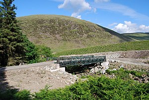
 Blackcraig Hill above the Afton Water | |||
| Range: | Carsphairn Hills | ||
| Summit: | 2,297 feet NS647064 55°19’59"N, 4°8’4"W | ||
Blackcraig Hill is a mountain in the Carsphairn Hills in the south of Ayrshire. It rises to a summit at 2,297 feet.
From the slopes of Blackcraig Hill and neighbouring Blacklorg Hill (2,234 feet, to the south on the border with Dumfriesshire) rise many of the burns which feed the River Nith: amongst them the Kello Water to the east, from Blacklorg; and the Afton Water to the west, rising on Alhang on the Kirkcudbrightshire border, and which flows north. Glen Afton in particular is carved in the landscape below Blackcriag's steep western slope, and burns off Blackcraig swell it.