Difference between revisions of "Garway Hill Common"
From Wikishire
(Created page with "{{Infobox hill |name=Garway Hill Common |county=Herefordshire |range= |picture=Garway Hill Common - geograph-2751785.jpg |picture caption=Garway Hill Common |os grid ref=SO437...") |
(No difference)
|
Latest revision as of 22:00, 31 July 2019
| Garway Hill Common | |
| Herefordshire | |
|---|---|
 Garway Hill Common | |
| Summit: | 1,201 feet SO437249 51°55’17"N, 2°49’14"W |
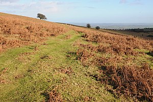
Garway Hill Common is a hill and area of common land in south-western Herefordshire, on the east side of the River Monnow, which marks the border with Monmouthshire. The common reaches a height of 1,201 feet.
Below the north-eastern slope of the hill is a hamlet named Garway Hill, from which the common is named, though the village seems to be named in turn after the hill which is the common.
The Herefordshire Trail walking route runs over the summit of Garway Hill Common.