Skirling: Difference between revisions
Jump to navigation
Jump to search
Created page with "{{Infobox town |name=Skirling |county=Peeblesshire |picture=Skirling - geograph.org.uk - 170472.jpg |picture caption=Skirling |os grid ref=NT070384 |latitude=55.630407 |longit..." |
No edit summary |
||
| (One intermediate revision by the same user not shown) | |||
| Line 7: | Line 7: | ||
|latitude=55.630407 | |latitude=55.630407 | ||
|longitude=-3.477649 | |longitude=-3.477649 | ||
|population= | |population=159 | ||
|census year= | |census year=2011 | ||
|post town= | |post town=Biggar | ||
|postcode=ML12 | |postcode=ML12 | ||
|dialling code= | |dialling code= | ||
|LG district= | |LG district=Scottish Borders | ||
|constituency= | |constituency=Dumfriesshire,<br />Clydesdale and Tweeddale | ||
}} | }} | ||
'''Skirling''' is a small village in [[Peeblesshire]], along the A72 in the very west of the county, close to the border with [[Lanarkshire]], marked here by the Spittal Burn and the Wintermuir Burn. [[Biggar]] in the latter county is the closest town. | '''Skirling''' is a small village and parish in [[Peeblesshire]], along the A72 in the very west of the county, close to the border with [[Lanarkshire]], marked here by the Spittal Burn and the Wintermuir Burn. [[Biggar]] in the latter county is the closest town and post town. | ||
Adjacent parishes are [[Broughton, Glenholm and Kilbucho]] to the east and south; [[Biggar]] in Lanarkshire to the west; [[Kirkurd]] to the north-east; and [[Walston]] and [[Dolphinton]] in Lanarkshire to the north. The latter four parishes along with Skirling itself all meet at a boundary stone on Broomy Law - a rare occurrence of five boundaries coming together at one point. | |||
{{commons}} | {{commons}} | ||
{{stub}} | {{stub}} | ||
Latest revision as of 20:15, 2 October 2017
| Skirling | |
| Peeblesshire | |
|---|---|
 Skirling | |
| Location | |
| Grid reference: | NT070384 |
| Location: | 55°37’49"N, 3°28’40"W |
| Data | |
| Population: | 159 (2011) |
| Post town: | Biggar |
| Postcode: | ML12 |
| Local Government | |
| Council: | Scottish Borders |
| Parliamentary constituency: |
Dumfriesshire, Clydesdale and Tweeddale |
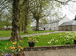
Skirling is a small village and parish in Peeblesshire, along the A72 in the very west of the county, close to the border with Lanarkshire, marked here by the Spittal Burn and the Wintermuir Burn. Biggar in the latter county is the closest town and post town.
Adjacent parishes are Broughton, Glenholm and Kilbucho to the east and south; Biggar in Lanarkshire to the west; Kirkurd to the north-east; and Walston and Dolphinton in Lanarkshire to the north. The latter four parishes along with Skirling itself all meet at a boundary stone on Broomy Law - a rare occurrence of five boundaries coming together at one point.
| ("Wikimedia Commons" has material about Skirling) |
This Peeblesshire article is a stub: help to improve Wikishire by building it up.
