Bourton, Berkshire: Difference between revisions
Created page with '{{Infobox town |name=Bourton |county=Berkshire |picture=Bourton Village Hall.JPG |picture caption=Village Hall, Bourton |os grid ref=SU2387 |latitude=51.582 |longitude=-1.667 |po…' |
No edit summary |
||
| (2 intermediate revisions by 2 users not shown) | |||
| Line 9: | Line 9: | ||
|population=320 | |population=320 | ||
|census year=2001 | |census year=2001 | ||
|post town= | |post town= | ||
|postcode=SN6 | |postcode=SN6 | ||
|dialling code=01793 | |dialling code=01793 | ||
|LG district=Vale of White Horse | |||
|constituency=Wantage | |||
}} | }} | ||
'''Bourton''' is a village in western [[Berkshire]] about | '''Bourton''' is a village in western [[Berkshire]] about four miles south-east of [[Highworth]] in neighbouring [[Wiltshire]]. The western boundary of the parish is a stream that also forms the county border. | ||
Bourton | Bourton originates as a tything in the ancient parish of [[Shrivenham]] and was erected as a civil parish in 1866.<ref name=Page>Page & Ditchfield, 1924, pages 531-543</ref> | ||
==Manor== | ==Manor== | ||
| Line 26: | Line 25: | ||
Bourton's common lands were enclosed in 1792.<ref name=Page/> | Bourton's common lands were enclosed in 1792.<ref name=Page/> | ||
In 1804–05 the Wilts & Berks Canal was extended eastwards from [[Swindon]] to [[Longcot]]. The canal passed through the northern part of Bourton parish, and Bourton Wharf was built beside the main road between Swindon and [[Faringdon]].<ref>Dalby, 2000, page 23</ref> The canal supplied coal mainly from the Somerset Coalfield and smaller amounts from the Forest of Dean Coalfield and [[Moira, Leicestershire|Moira]]. | In 1804–05 the [[Wilts & Berks Canal]] was extended eastwards from [[Swindon]] to [[Longcot]]. The canal passed through the northern part of Bourton parish, and Bourton Wharf was built beside the main road between Swindon and [[Faringdon]].<ref>Dalby, 2000, page 23</ref> The canal supplied coal mainly from the Somerset Coalfield and smaller amounts from the Forest of Dean Coalfield and [[Moira, Leicestershire|Moira]]. | ||
[[File:Bourton Grange.JPG|thumb|left|200px|Bourton Grange in Lower Bourton]] | [[File:Bourton Grange.JPG|thumb|left|200px|Bourton Grange in Lower Bourton]] | ||
The Great Western Main Line railway was built through the parish in 1840, passing just north of Lower Bourton. Shrivenham railway station was opened half a mile northeast of Bourton village on the boundary between the two parishes. Acorn Bridge was built for the Great Western in the western part of Bourton parish close to the Wiltshire county boundary. It is a brick bridge, built askew, and is a "double bridge", which is to say it has two arches: the easterly one spanned the canal and the westerly one spanned the Swindon to Faringdon main road. | The Great Western Main Line railway was built through the parish in 1840, passing just north of Lower Bourton. Shrivenham railway station was opened half a mile northeast of Bourton village on the boundary between the two parishes. Acorn Bridge was built for the Great Western in the western part of Bourton parish close to the Wiltshire county boundary. It is a brick bridge, built askew, and is a "double bridge", which is to say it has two arches: the easterly one spanned the canal and the westerly one spanned the Swindon to Faringdon main road. | ||
Despite railway competition, Bourton Wharf's trade continued to increase until 1848, when 823 long tons of Somerset coal were landed there.<ref name=Dalby119>Dalby, 2000, page 119</ref> Thereafter however the railway increasingly dominated coal and other freight traffic, and trade at Bourton Wharf declined rapidly. Bourton Wharf had a small revival in the | Despite railway competition, Bourton Wharf's trade continued to increase until 1848, when 823 long tons of Somerset coal were landed there.<ref name=Dalby119>Dalby, 2000, page 119</ref> Thereafter however the railway increasingly dominated coal and other freight traffic, and trade at Bourton Wharf declined rapidly. Bourton Wharf had a small revival in the 1860s but in 1876 the wharf received only 27 tons of Somerset coal,<ref name=Dalby119/> which equates to a full cargo for only one narrowboat in the entire year. Bourton Wharf handled small amounts of cargo in the mid-1890s, at least some of which was local traffic to or from [[Melksham]] and [[Wantage]].<ref>Dalby, 2000, pages 123–124</ref> By this time the Wilts & Berks' maintenance and dredging had deteriorated to the extent that narrowboats could not operate fully laden. In 1901 the Stanley Aqueduct over the River Marden in Wiltsire collapsed and the little remaining traffic virtually ceased. The Wilts & Berks Canal was formally abandoned in 1914. | ||
After the First World War, the Swindon to Faringdon main road was classified as the A420. Later in the 20th century the road through Acorn Bridge was widened and realigned to relieve the S-bend by which the road passes under the railway. The westbound carriageway was re-routed through the easterly arch that is no longer used by the canal, and the westerly arch remained in use by only the eastbound carriageway. | After the First World War, the Swindon to Faringdon main road was classified as the A420. Later in the 20th century the road through Acorn Bridge was widened and realigned to relieve the S-bend by which the road passes under the railway. The westbound carriageway was re-routed through the easterly arch that is no longer used by the canal, and the westerly arch remained in use by only the eastbound carriageway. | ||
| Line 47: | Line 46: | ||
==Churches== | ==Churches== | ||
[[File:Bourton StJames.JPG|thumb|left|170px|St James' parish church]] | [[File:Bourton StJames.JPG|thumb|left|170px|St James' parish church]] | ||
[[File:Bourton StJames interior.JPG|right|thumb|200px|Interior of St James' parish church | |||
The parish church is St James's, designed by the Gothic Revival architect J W Hugall.<ref name=Pevsner92/> Page and Ditchfield state it was built in 1881<ref name=Pevsner92/> but Pevsner states it was built in 1860.<ref name=Pevsner92/> | The parish church is St James's, designed by the Gothic Revival architect J W Hugall.<ref name=Pevsner92/> Page and Ditchfield state it was built in 1881<ref name=Pevsner92/> but Pevsner states it was built in 1860.<ref name=Pevsner92/> | ||
| Line 52: | Line 52: | ||
Bourton Baptist Church was built in 1851 in a Decorated Gothic style<ref name=Pevsner92>Pevsner, 1966, page 92</ref> for the owner of Bourton House.<ref name=Page/> It is now the village hall.<ref>[http://www.oxfordshirechurches.info/Bourton.html Oxfordshire Churches & Chapels: Bourton]</ref> | Bourton Baptist Church was built in 1851 in a Decorated Gothic style<ref name=Pevsner92>Pevsner, 1966, page 92</ref> for the owner of Bourton House.<ref name=Page/> It is now the village hall.<ref>[http://www.oxfordshirechurches.info/Bourton.html Oxfordshire Churches & Chapels: Bourton]</ref> | ||
==References== | ==References== | ||
| Line 65: | Line 57: | ||
*{{cite book |title=The Wilts and Berks Canal |last=Dalby |first=L.J. |authorlink=|edition=3rd |year=2000 |origyear=1971 |publisher=Oakwood Press |location=Usk |isbn=0-85361-562-4 |pages=23, 119, 123, 124}} | *{{cite book |title=The Wilts and Berks Canal |last=Dalby |first=L.J. |authorlink=|edition=3rd |year=2000 |origyear=1971 |publisher=Oakwood Press |location=Usk |isbn=0-85361-562-4 |pages=23, 119, 123, 124}} | ||
*{{ | *{{VCH|vol=4|page=531–543}} | ||
*{{ | *{{Pevsner|page=92}} | ||
Latest revision as of 17:49, 10 June 2017
| Bourton | |
| Berkshire | |
|---|---|
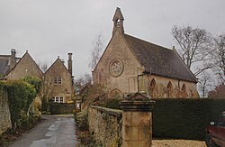
 Village Hall, Bourton | |
| Location | |
| Grid reference: | SU2387 |
| Location: | 51°34’55"N, 1°40’1"W |
| Data | |
| Population: | 320 (2001) |
| Postcode: | SN6 |
| Dialling code: | 01793 |
| Local Government | |
| Council: | Vale of White Horse |
| Parliamentary constituency: |
Wantage |
Bourton is a village in western Berkshire about four miles south-east of Highworth in neighbouring Wiltshire. The western boundary of the parish is a stream that also forms the county border.
Bourton originates as a tything in the ancient parish of Shrivenham and was erected as a civil parish in 1866.[1]
Manor
Bourton seems to have begun as part of the manor of Shrivenham.[1] Its name evolved from Burghton in the 14th century by way of Borton in the 17th century and has appeared also as Burton.[1] In 1476 George Talbot, 4th Earl of Shrewsbury was feudal overlord of the manor of Buckand in Over Bourton.[1] The manor had been held of the Earl by Sir William Lovel, Lord Morley, who died in that year.[1] In 1529 the manor was recorded as being "late of Sir Francis Lovell", who was attainted in 1485 for supporting Richard III and died childless in 1487.[1] The manor was still owned by the Crown in 1529 but was leased from 1542.[1] From then until 1664 the Hinton family held the manor, but no subsequent record of it is known.[1]
Economic history
Bourton's common lands were enclosed in 1792.[1]
In 1804–05 the Wilts & Berks Canal was extended eastwards from Swindon to Longcot. The canal passed through the northern part of Bourton parish, and Bourton Wharf was built beside the main road between Swindon and Faringdon.[2] The canal supplied coal mainly from the Somerset Coalfield and smaller amounts from the Forest of Dean Coalfield and Moira.

The Great Western Main Line railway was built through the parish in 1840, passing just north of Lower Bourton. Shrivenham railway station was opened half a mile northeast of Bourton village on the boundary between the two parishes. Acorn Bridge was built for the Great Western in the western part of Bourton parish close to the Wiltshire county boundary. It is a brick bridge, built askew, and is a "double bridge", which is to say it has two arches: the easterly one spanned the canal and the westerly one spanned the Swindon to Faringdon main road.
Despite railway competition, Bourton Wharf's trade continued to increase until 1848, when 823 long tons of Somerset coal were landed there.[3] Thereafter however the railway increasingly dominated coal and other freight traffic, and trade at Bourton Wharf declined rapidly. Bourton Wharf had a small revival in the 1860s but in 1876 the wharf received only 27 tons of Somerset coal,[3] which equates to a full cargo for only one narrowboat in the entire year. Bourton Wharf handled small amounts of cargo in the mid-1890s, at least some of which was local traffic to or from Melksham and Wantage.[4] By this time the Wilts & Berks' maintenance and dredging had deteriorated to the extent that narrowboats could not operate fully laden. In 1901 the Stanley Aqueduct over the River Marden in Wiltsire collapsed and the little remaining traffic virtually ceased. The Wilts & Berks Canal was formally abandoned in 1914.
After the First World War, the Swindon to Faringdon main road was classified as the A420. Later in the 20th century the road through Acorn Bridge was widened and realigned to relieve the S-bend by which the road passes under the railway. The westbound carriageway was re-routed through the easterly arch that is no longer used by the canal, and the westerly arch remained in use by only the eastbound carriageway.
Shrivenham railway station continued to serve Bourton and Shrivenham until 1964, when British Railways withdrew all local passenger services between Didcot and Swindon and closed all intermediate stations including Shrivenham.
Social history

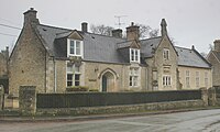
Bourton village school was built in 1842[5] and evidently later extended with the addition of a second classroom. It was still open after 1920[1] but has since closed.
Six almshouses were established in 1847 by the same benefactors who had founded the school.[1]
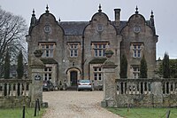
Bourton House was built in 1845.[5] It is now the premises of Pinewood School, a co-educational preparatory school founded in 1875.[6]
Churches

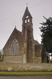
[[File:Bourton StJames interior.JPG|right|thumb|200px|Interior of St James' parish church The parish church is St James's, designed by the Gothic Revival architect J W Hugall.[5] Page and Ditchfield state it was built in 1881[5] but Pevsner states it was built in 1860.[5]
St James' parish is now part of a single Benefice with the parishes of Ashbury, Compton Beauchamp, Fernham, Longcot, Shrivenham and Watchfield. Low attendance and a parish deficit of £6,000 a year led the Diocese of Oxford to serve notice at the end of 2003 to make St James' redundant.[7] After increased attandance and a £2,000 increase in parish income from January 2004, the Diocese rescinded the notice by June of that year.[7]
Bourton Baptist Church was built in 1851 in a Decorated Gothic style[5] for the owner of Bourton House.[1] It is now the village hall.[8]
References
- ↑ 1.00 1.01 1.02 1.03 1.04 1.05 1.06 1.07 1.08 1.09 1.10 1.11 Page & Ditchfield, 1924, pages 531-543
- ↑ Dalby, 2000, page 23
- ↑ 3.0 3.1 Dalby, 2000, page 119
- ↑ Dalby, 2000, pages 123–124
- ↑ 5.0 5.1 5.2 5.3 5.4 5.5 Pevsner, 1966, page 92
- ↑ Pinewood School
- ↑ 7.0 7.1 "Church fights off closure as villagers flock to services". The Door. June 2004.
- ↑ Oxfordshire Churches & Chapels: Bourton
- Dalby, L.J. (2000) [1971]. The Wilts and Berks Canal (3rd ed.). Usk: Oakwood Press. pp. 23, 119, 123, 124. ISBN 0-85361-562-4.
- A History of the County of Berkshire - Volume pp 531–543: {{{2}}} (Victoria County History)
- Nikolaus Pevsner: The Buildings of England: Berkshire, 1966; 2010 Penguin Books ISBN 978-0-300-12662-4page 92