St Brides Bay

St Brides Bay is a rocky bay inlet in western Pembrokeshire.
Either Skomer Island or the mainland extremity of Wooltack Point at the western end of the Marloes Peninsula marks the southern limit of the bay whilst its northern limit is marked by Ramsey Island off St David's Head. The mouth of the bay is around 7 miles wide; the bay extends some 10 miles eastwards from this line.[1]
Geology
The northern and southern shores of the bay are mainly rocky in nature, backed by cliffs up to 250 feet in height. Its eastern shore comprises a series of large and small sandy beaches between rocky sections.
The geological exposures around the bay reveal great complexity with considerable folding and faulting of the strata. The cliffs of its southern shore are formed from sandstones of Ordovician and Devonian age together with a suite of both intrusive and extrusive igneous rocks, some of which are Precambrian in age. Those in the north comprise a series of Precambrian and Cambrian age rocks of both sedimentary and igneous origin. In contrast, the eastern shore is formed from the more readily eroded rocks of Carboniferous age. These are largely the sandstones and mudstones of the Coal Measures but include a small section of shales and sandstones assigned to the Millstone Grit Series.[2] Contorted coal seams within the Coal Measures were once worked though the Pembrokeshire Coalfield was never of major economic importance.
Designations
The coast surrounding it forms a part of the Pembrokeshire Coast National Park which was designated in 1951 in recognition of the outstanding quality of its landscape. Much of the coastline is also defined as heritage coast.[3] The whole of St Bride's Bay along with adjoining areas of sea around the Pembrokeshire Coast is protected under European environmental law as a special area of conservation (or 'SAC'). Parts of the coast are additionally defined as special protection areas (or 'SPAs'). There are also three or four sites of special scientific interest (or 'SSSIs') around its perimeter.[4]
Villages and amenities
The bay's coast is dotted with small villages including St Brides, Martin's Haven, Little Haven, Broad Haven, Nolton Haven, Newgale and Solva, whilst Britain's smallest city, St David's lies nearby. The Pembrokeshire Coast Path follows its entire coastline.
It is well known among residents and tourists for fishing.
Outside links
-
 New cloisters, St. David's
 -
 Colourful cottages in Solva
 -
 Clock tower, Marloes
 -
 Fishing at sunset, Little Haven
 -
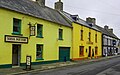
 St. Bride's Inn, Little Haven
 -
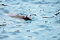 Seal at St. David's, Pembrokeshire


References
- ↑ Ordnance Survey 1:50,000 Landranger map sheet 157
- ↑ British Geological Survey 1:50,000 scale geological map series of England and Wales, sheets 209 St. David's and 226/227 'Milford'
- ↑ http://www.britainexpress.com/countryside/coast/st-brides.htm Retrieved on 2008-01-07
- ↑ Countryside Council for Wales 2008, Internationally protected areas in Wales (poster)