Snelston
| Snelston | |
| Derbyshire | |
|---|---|
 The lodge and church | |
| Location | |
| Grid reference: | SK151434 |
| Location: | 52°59’17"N, 1°46’34"W |
| Data | |
| Population: | 202 (2011) |
| Post town: | Ashbourne |
| Postcode: | DE6 |
| Local Government | |
| Council: | Derbyshire Dales |
Snelston is a village three miles south-west of Ashbourne, in Derbyshire. The wider parish includes Anacrehill, and the population of this parish was recorded in the 2011 census as 202.
A tributary of the River Dove flows through the middle of the village, to join the Dove itself just three-quarters of a mile to the east. The River Dove marks the border of Staffordshire, and is crossed by a footbridge known as the Toadhole Footbridge.

About the village
The parish church is St Peter's Church. It was substantially rebuilt (except for the tower) in 1825.[1] It is one of the few churches to have had dances regularly held on the roof.[2]
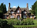
Snelston Hall was the great house of the village, built in 1827 and demolished in 1951. The local squire, John Harrison had the village remodelled and a new school built in 1847. The village buildings were designed by the architect Lewis Nockalls Cottingham, as a 'model village'.
Pictures
| ("Wikimedia Commons" has material about Snelston) |
-
 The war memorial
 -
 The Old Post Office
 -
 School Farm
 -
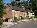
 Brook Cottages
 -
 Church of St. Peter
 -
 Nave of the church of St. Peter
 -
 Sanctuary of the church of St. Peter


Outside links
- Snelston at DerbyshireUK
- Snelston.com
References
- ↑ Nikolaus Pevsner: The Buildings of England: Derbyshire, 1953; 1978 Penguin Books ISBN 978-0-300-09591-3
- ↑ Bowyer, L.J. Rev. 1953. The Ancient Parish of Norbury. Ashbourne. J.B. Henstock. Page 29.