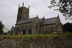
Roborough, North Devon
Jump to navigation
Jump to search
Not to be confused with Roborough, north of Plymouth
| Roborough | |
| Devon | |
|---|---|
 Roborough Church | |
| Location | |
| Grid reference: | SS576170 |
| Location: | 50°56’9"N, 4°1’39"W |
| Data | |
| Postcode: | EX19 |
| Dialling code: | 01805 |
| Local Government | |
| Council: | Torridge |
| Parliamentary constituency: |
Torridge and West Devon |
Roborough is a village in northern Devon, found five and a half miles from Great Torrington. It stands on the plateau between the River Torridge and the River Taw, and in the whole parish are some 258 souls, according to the 2011 census. It is surrounded by a pastoral landscape of rectangular fields, high hedges and scattered farmsteads.
Historic estates

Various historic estates are situated within the parish of Roborough, including:
- Owlacombe, listed in the Domesday Book of 1086 as the seventh of the twenty-seven Devonshire holdings of Theobald FitzBerner (fl.1086),[1] one of the tenants-in-chief of King William the Conqueror. His tenant was Gotshelm. The mansion house survives today as "Owlacombe", south-west of the village of Roborough.
- Combe or Over Wollocombe, a seat of the Wollocombe family, and later successors.
- Ebberly, a hamlet within Roborough parish with a mansion house known as Ebberly Barton, and a Methodist chapel. This estate is first recorded, as Emberlegh, in the 13th century Book of Fees.[2] Ebberly House is a Grade II* listed building.
References
- ↑ Thorn, Caroline & Frank, (eds.) Domesday Book, (Morris, John, gen.ed.) Vol. 9, Devon, Parts 1 & 2, Phillimore Press, Chichester, 1985, Part 1, 36:7, Part 2 (Notes), 36:7
- ↑ Thorn, Caroline & Frank, (eds.) Domesday Book, (Morris, John, gen.ed.) Vol. 9, Devon, Parts 1 & 2, Phillimore Press, Chichester, 1985, Part 2 (notes), 3:19