Penally
| Penally Welsh: Penalun | |
| Pembrokeshire | |
|---|---|
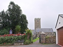
 St Florence's church | |
| Location | |
| Grid reference: | SS1170099221 |
| Location: | 51°39’36"N, 4°43’23"W |
| Data | |
| Post town: | Tenby |
| Postcode: | SA70 |
| Dialling code: | 01834 |
| Local Government | |
| Council: | Pembrokeshire |
| Parliamentary constituency: |
Carmarthen West and South Pembrokeshire |
Penally is a coastal village and parish a mile south-west of Tenby in Pembrokeshire. The village is known for its Celtic Cross, Penally Abbey (a Gothic-style country house), the neighbouring St Deiniol's Well, and Penally Training Camp (World War I and World War II).
History
Archaeological investigations of nearby Hoyles Mouth Cave shows evidence of paleolithic and iron-age use.[1] Artifacts found there can be seen at Tenby Museum.
Transport
The village is served by Penally railway station (a request stop, with stations towards Pembroke Dock to the west, Carmarthen and beyond to the east) and bus services 349 and 380 (Tenby Town Circular Service).
Amenities
The local parish church is dedicated to St Nicholas & St Teilo. It was originally called St Nicholas' but was changed at the end of the 19th century; it is suggested that Penally was the birthplace of St Teilo, a Christian leader in the 6th century.[2] The church houses the Penally Celtic cross[3] which was originally located in the graveyard but has since been restored and moved into the church.
The village has two pubs, The Cross Inn and The Paddock, a night club, and a small shop.
Views overlook Tenby, Caldey Island, Giltar Point, and Tenby Golf Course, which runs alongside Tenby South Beach to the south of the village. Waymarked public footpaths allow people to walk through the links to the beach and to Tenby. Another golf course lies inland, on the outskirts of the village, at Trefloyne.
Military establishment
A firing range owned by the Ministry of Defence is located adjacent to Giltar Point on the coast. The range, which was built in the middle of the 19th century, was used to train soldiers during World War I and World War II. When the firing range is being used, red flags are flown and there are sometimes sentries stationed at huts along the perimeter line. Part of the Pembrokeshire Coast Path is diverted along the A4139 road when the firing range is in use. The firing range has its own byelaws, which are reproduced on signs around the firing range perimeter and must be obeyed. The remains of the World War I practice trenches may be found towards the east of Giltar Point along the Pembrokeshire Coast Path.[4]
References
- ↑ "Royal Commission on the Ancient and Historical Monuments of Wales (Coflein), 2008". http://www.coflein.gov.uk/en/site/304237/details/HOYLE%27S+MOUTH+CAVE/. Retrieved 11 May 2014.
- ↑ "Royal Commission, 2008 - St Nicholas & St Teilo". http://www.coflein.gov.uk/en/site/400386/details/ST+NICHOLAS%27+CHURCH%3B+ST+TEILO%27S+CHURCH%2C+PENALLY/. Retrieved 11 May 2014.
- ↑ "Royal Commission, 2008 - Penally Celtic Cross". http://www.coflein.gov.uk/en/site/276028/details/PENALLY+CROSS%2C+ST+NICHOLAS%27+CHURCH%2C+PENALLY/. Retrieved 11 May 2014.
- ↑ "Royal Commission, 2008 - Penally First World War Practice Trenches". http://www.coflein.gov.uk/en/site/268143/details/PENALLY+FIRST+WORLD+WAR+PRACTICE+TRENCHES/. Retrieved 11 May 2014.