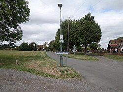
Mangrove Green
Jump to navigation
Jump to search
| Mangrove Green | |
| Hertfordshire | |
|---|---|
 Mangrove Green | |
| Location | |
| Grid reference: | TL123238 |
| Location: | 51°54’6"N, 0°22’4"W |
| Data | |
| Post town: | Luton |
| Postcode: | LU2 |
| Local Government | |
| Council: | North Hertfordshire |
| Parliamentary constituency: |
Hitchin and Harpenden |
Mangrove Green is a hamlet in northern Hertfordshire, close by the border with Bedfordshire and sitting just north of Cockernhoe. Its population is 108. It is built on a single lane running directly north from Cockernhoe, which is a dead-end lane, with closes off it, and no more.
The village has a green, as its name suggests, and one pub, the King William IV. The lane continues to a farmstead, and can then be followed only on footpaths over the fields northwards to Lilley, to which estate it long belonged.
This Hertfordshire article is a stub: help to improve Wikishire by building it up.