Macroom
| Macroom | |
| County Cork | |
|---|---|
 Castle Arch, showing relocated Olive Ardilaun's cannons | |
| Location | |
| Grid reference: | W337729 |
| Location: | 51°54’16"N, 8°57’25"W |
| Data | |
| Population: | 3,879 (2011) |
| Local Government | |
| Council: | County Cork |
Macroom is a market town in the West Riding of County Cork. It is situated in a valley of the River Sullane, about halfway between Cork and Killarney. The name in Irish Gaelic may mean "meeting place of followers of the god Crom" or "crooked oak",[1] the latter derived from a large oak tree said to have grown at one time in the town-square, which was first marked out during the reign of King John.[2]
In folklore the town began as a meeting place for the Druids of Munster, and is first mentioned in 6th century records. It was the site of a major battle involving Brian Boru around 1014, and in the following centuries suffered a series of invasions by warring families, including the Murcheatach Uí Briain and Richard de Cogan clans. In the 17th century the MacCarthy family took control and led Macroom towards prosperity through milling, markets and fairs. This fortune was short lived and followed by the Williamite wars of the 1690s when authority over the town castle waxed and waned between the Irish MacCarthys and a number of ambitious English families. Later Macroom became a centre point of conflict in the Cromwellian conquest of Ireland.
The population was decimated in the 1840s by famine and emigration, the former evidenced by the remains of a workhouse, now the district hospital, and a mass graveyard to the west, near Clondrohid. During the 19th century a number of Anglo-Irish families settled in the area but many of their estate houses were burned out by rebels during and after the IIrish War of Independence as the town was caught up in a turmoil of IRA activity. Eventually the Anglo-Irish families fled, leaving behind tracts of land that were, in the end, distributed among the wealthier of their former tenants.
Traditionally Macroom is known as "the town that never reared a fool."[3][4] The broader urban area recorded a population of 3,553 in the 2006 national census. In 1977 it hosted the first Mountain Dew festival, with Rory Gallagher as the main attraction.
History
Pre-Christian
Evidence of life in and around Macroom during the Iron Age survives through the people's burial rights, mostly in the form of the many standing stones, dolmens and stone circles that are so numerous in the surrounding land.[5] The area seems to have been a centre for Bardic conventions and a base for the Druids of Munster.[6] The first historical reference to Macroom dates from the 6th century, when the townland was known as Achad Dorbchon and held within the kingdom of Muscraighe Mitine.[7] The Eóganachtas were then the dominant clan of Munster; they held kingdoms from Muscraighe Mitine to the depressing and bleak midlands town of Birr. At some point they were replaced by the Uí Floinn, who commissioned a castle in Macroom so as to establish Raithleann as the capital of Muskerry.
MacCarthy family

Muscraighe Mitine underwent three invasions during the 13th century. They began with the Murcheatach Uí Briain and Richard de Cogan in 1201 and 1207 respectively, and were won by the MacCarthys, who became the dominant and most powerful family in Muscraighe Uí Fhloinn. The MacCarthys went on to hold Macroom castle until the middle of the 17th century. From the 14th century, Macroom became the capital of the Barony of Muskerry and the centre for trade, burial and religious worship.[9]
Macroom was one of the earliest centres in Ireland where milling was carried out. From the end of the 16th century the town began to grow from a village settlement to a functionally diverse urban centre. The locality grew outwards from the castle. The MacCarthys established the town as a centre for markets and fairs, and in 1620 a market house was built to the east of and facing the castle. The family introduced a plantation scheme which aimed to attract new agriculture and industrial techniques and methods to the area. By the mid-17th century English families owned approximately one-third of the town in value terms.[10] The Protestant families introduced butter making to the town; an industry that was labour-intensive and had a positive effect on local dairy farming.
The 1650 battle of Macroom was fought as part of the Cromwellian conquest of Ireland. Bishop Boetius MacEgan, fighting on behalf of the MacCarthys, failed to hold the castle and was taken prisoner by the Cromwellian forces and hanged at Carrigadrohid.[11]
A 1750 tenement list details 134 buildings and 300 families, with a population ratio of 6 to 1 between Catholic and Protestants. The town had developed from a locality of mud cabins in the early 1660s to a linear shaped urban settlement of mainly thatched cabins, which were later replaced by solid cottages following a campaign by the Irish Land and Labour Association (ILLA).

Macroom castle was for a period in the ownership of Admiral Sir William Penn, a distinguished British Admiral and father of William Penn, after whom the US state of Pennsylvania is named. Penn spent time in his fathers Irish home, particularly during his childhood.
War of Independence
Macroom was the main base in Cork for the British Auxiliary Division during the 1919–1921 Irish War of Independence. The Irish Republican Army was highly active in the county, especially in the areas around Macroom, Bandon and Dunmanway. Royal Irish Constabulary police in the town described the area as "practically in a state of war". After a series of burnings of local police barracks and courthouses[12] a curfew was imposed on the town, with a ban on public meetings and market fairs. A local IRA member wrote of a "hinterland unpoliced and unwatched". The local police felt they had lost control and the Auxiliaries were called in. The local townspeople treated them with hostility, and there were instances of patrols being stoned. They quickly found themselves embroiled in a guerrilla battle in the Muskerry hills, coming under fire from the Ballyvourney IRA cell, and lost three men – two of them officers – in one attack.[13]
In 1920 at Kilmichael, on the road between Macroom and Dunmanway, 17 members of the Macroom Auxiliary "C Company" were ambushed and killed by a local IRA cell lead by the prominent general Tom Barry. In the aftermath of the attack, the British military were given the power to execute anyone found carrying arms and ammunition, to search houses, impose curfews, try suspects in military rather than civilian courts and to intern suspects without trial. On 11 December, in reprisal, the centre of Cork city was burned by Auxiliaries, British soldiers and Black and Tans.[14]
Macroom castle was burned out on five separate occasions; the last occasion was on 18 August 1922 following the evacuation of British Auxiliaries from the town. Members of anti-treaty forces, including Erskine Childers and Frank O'Connor, had retreated from Cork City to Macroom. They burned the castle before retreating west. Michael Collins was killed in 1922 in an ambush near Béal na Bláth.
Lady Olivia Ardilaun, a descendant of the McCarthy chiefs, and the widow of Lord Ardilaun, sold the castle demesne in 1924[15] to a group of local businessmen, to be held in trust for the people of the town.
Geography
The town lies on the River Sullane, a tributary of the River Lee. It and its hinterland are positioned in a valley at the foot of the Boggeragh Mountains. The town streaches for about two miles and largely consists of two long streets, Main Street and New Street, which are divided by a ten arch bridge which also leads off to the subarb of Massey Town and further towards the village of Ballinagree and the Boggeragh Mountains. Until the 1950s new Street was an economic hub, with many small retail outlets.

The Gearagh, a national nature reserve which comprises an inland delta, is located a mile south of Macroom. It comprises a series of small islands, separated by anastomosing, mostly flat, river channels or streams,[16] and is bounded by Toon bridge, Illaunmore, and Anahala Bridge. The area is thought to have been wooded since the end of the last Ice Age c. 8,000 bc.[17] The alluvial woodland extended as far as the Lee Bridge, and consisted of a large number of mature oak and ash trees.[18] The reserve was gutted in 1954 when the Lee hydro-electric scheme led to extensive tree-felling and flooding in the area. The scheme resulted in the loss of sixty per-cent of the former oak woodland.[17] Today, the Gearagh is of great natural importance due to its rich and rare diversity of wildlife, and represents the only extant extensive alluvial woodland in Western Europe.[19]
Economic
Tourism

Tourist attractions include the town centre and an 18-hole golf course; the Castle Grounds, with fishing and golfing facilities, is another touristic place.
In the surroundings there are holy wells, churches and other sacred sites associated with ancient visionaries and healers. A few kilometres to the north of Macroom is Mushera Mountain, with the family attraction of Millstreet Country Park, a mile walk to the summit of the mountain, and the ancient Saint John's Well. Carrigaphooca Castle lies three miles west of the town. The Castle Arch, a centrepiece of the old castle grounds, admits walkers to the demesne parklands. It is still held in trust as a gift to, and possession of, the people of Macroom. This large park contains riverside walks among mature oak and beech trees. In early October it becomes an area of keen interest to mushroom enthusiasts. Macroom Oatmeal is milled here by the traditional stone-grinding process at Walton's Mill.
Transport

Macroom is on the national primary route N22, approximately 23 miles from Cork and 30 miles from Killarney. The nearest airport is Cork Airport.
A railway ran between the town and Cork city from 1866 to 1953, terminating in the mart grounds. By 1890 there were five services each way on week days and two on Sundays, with the running time taking just over an hour. Macroom railway station opened on 12 May 1866; it closed for passenger traffic on 1 July 1935 and for goods traffic on 10 March 1947, and was finally shut down on 1 December 1953.[20]
Education
The town has two primary schools and three secondary schools; a De La Salle for boys, St Mary's Secondary School Convent of Mercy for girls, and McEgan College, a mixed technical college located in the castle grounds.
The Convent of Mercy Secondary School is contained within the Sisters of Mercy's complex attached to St Colmans church, which also includes a convent, primary school, graveyard and grotto. Coláiste De La Salle was opened in 1933 and originally located in the town hall, until a permanent building was completed three years later. By the late 1970s the school was experiencing severe capacity issues and a re-structure and extension of the school was undertaken in 1982.[21] Since its opening the ratio of pupils has remained relatively stable with 40% from coming the town and the rest from surrounding parishes. A new building was built in 2008 for St Colmans Boys National School after years of planning applications and appeals.
Notable people
- Michael John O'Leary, recipient of the Victoria Cross
- John A. Murphy - historian and former senator
- Donal Creed - former Teachta Dála
Gallery
-
 Bridge over the River Sullane
 -
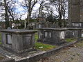 Graveyard in the abandoned Protestant churchyard


References
- ↑ It is one of many Irish place names derived from the name of the God Crom (How & Parsons, 393)
- ↑ Lewis, Samuel. "MACROOM, COUNTY CORK IN LEWIS TOPOGRAPHICAL DICTIONARY OF IRELAND 1837". Retrieved 2 January 2011. Google Books
- ↑ O'hAodha, Micheal. Theatre in Ireland, page 72 (Rowman and Littlefield, 1974). Retrieved 2 May 2011.
- ↑ O’Connell, Brian. "Anglers, hikers and history buffs find much to celebrate in Ireland's County Cork", New York Daily News (14 March 2010). Retrieved 2 May 2011.
- ↑ "Macroom: Town Profile". agriculture.gov.ie. Retrieved on 19 March 2007.
- ↑ "History of Macroom". apieceofireland.com. Retrieved on 19 March 2007.
- ↑ Ring, 31
- ↑ "History of Macroom Town Hall". Macroom UDC. Retrieved 14 December 2013
- ↑ Ring, 80
- ↑ Ring, 105
- ↑ Boetius MacEgan, Bishop of Ross Biography
- ↑ Hart, 27
- ↑ Hart, 28
- ↑ White & O'Shea, 9
- ↑ Keane, Barry. "Protestant Cork in decline 1911-1926; Murders, Mistakes, Myths, and Misinformation"
- ↑ "The Gearagh". University College Cork. Retrieved on 19 March 2007
- ↑ 17.0 17.1 "The Gearagh". National Parks & Wildlife Service, 1997. Retrieved on 19 March 2007.
- ↑ O'Reilly, 279-286
- ↑ "The Gearagh ". Failte Ireland, 2004. Retrieved on 19 March 2007.
- ↑ "Macroom station". Railscot - Irish Railways. http://www.railscot.co.uk/Ireland/Irish_railways.pdf. Retrieved 2007-11-03.
- ↑ "Coláiste De La Salle". Retrieved on 19 March 2007.
Sources
- Hart, Peter M. The I.R.A. and Its Enemies: Violence and Community in Cork, 1916-1923. Oxford: Clarendon Press, 1999
- How and Parsons. "Ireland, its scenery, character, etc", 1841
- O'Reilly, H. "Survey of the Gearagh, an Area of Wet Woodland on the River Lee, near Macroom, Co. Cork". The Irish Naturalists' Journal, Vol. 11, No. 10, 1955. 279-286
- Ring, Denis Paul. A Historical Geography of Macroom C.500-1995. Castle House Publications, 1995.
- White, Gerry & O'Shea, Brendan. "The Burning of Cork". Cork: Mercier Press, 2006.
Outside links
| ("Wikimedia Commons" has material about Macroom) |