Little London, Leeds
| Little London | |
| Yorkshire West Riding | |
|---|---|
 Little London Community Centre | |
| Location | |
| Grid reference: | SE303346 |
| Location: | 53°48’27"N, 1°32’26"W |
| Data | |
| Post town: | Leeds |
| Postcode: | LS7 |
| Dialling code: | 0113 |
| Local Government | |
| Council: | Leeds |
| Parliamentary constituency: |
Leeds Central |
Little London is a residential area of Leeds in the West Riding of Yorkshire, north of the city centre and Leeds Inner Ring Road.
This place is so called because in the 19th century it had fashionable housing and interesting architecture comparable to London.[1] In the 1950s and '60s it became largely council housing[2] and now consists of a mixture of high and low-rise flats and housing. The area falls within the Little London and Woodhouse ward of the City of Leeds Council. The area is divided into four estates; Lovell Park, Oatlands, Carlton and the Servias.
History

The area developed around an area then known as The Leylands in the 18th century, originally as a largely working class residential area housing workers for the area's textile industry. In 1865 the Carlton Barracks opened in the area and is still open. By the 1950s the area had become dilapidated, with much of the area's back-to-back housing being considered unfit for human habitation, and the area was redeveloped in a slum clearance scheme;[3][4] around the same time the layout of the area was changed by the construction of the Leeds Inner Ring Road and the Sheepscar Interchange. As part of the area's redevelopment, the main thoroughfare, Camp Road, was renamed Lovell Park Road to the south and Oatlands Lane further north. There are a few buildings in the area that predate the redevelopment during the 1960s and 1970s, All Souls' Church being one of them. A more modest redevelopment of the area was undertaken in the 2010s.
-
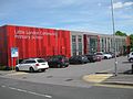 Primary School
 -
 Part of the Carlton estate
 -
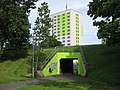 Subway from the Carlton estate to Oatland Towers
 -
 More modern buildings on Carlton Gate
 -
 Carlton Barracks 2007
 -
 The Leeds Rifleman


Outside links
| ("Wikimedia Commons" has material about Little London, Leeds) |
References
- ↑ John Gilleghan (2001) Leeds: An A to Z of Local History ISBN 0951919431
- ↑ Leodis In and around Little London tour 1
- ↑ "Albert Grove". Leodis. 1956. http://www.leodis.net/display.aspx?resourceIdentifier=2003227_60892886.
- ↑ "Aerial View, Meanwood Road, Camp Road". Leodis. 1963. http://www.leodis.net/display.aspx?resourceIdentifier=20031112_48699588.