High Wycombe
| High Wycombe | |
| Buckinghamshire | |
|---|---|
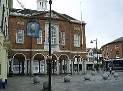
 High Wycombe Guildhall, at the end of the High Street | |
| Location | |
| Grid reference: | SU867929 |
| Location: | 51°37’43"N, -0°44’54"W |
| Data | |
| Population: | 92,300 |
| Post town: | High Wycombe |
| Postcode: | HP10-15 |
| Dialling code: | 01494 |
| Local Government | |
| Council: | Buckinghamshire |
| Parliamentary constituency: |
Wycombe |
High Wycombe is a large town in Buckinghamshire. It was known as Chepping Wycombe or Chipping Wycombe, a name which survives in the civil parish of Chepping Wycombe.
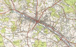
The town is on the River Wye, though some say that the river was named form the town not the town from the river; it is said to have been given its name by Sandhurst cadets out map-making. High Wycombe's distance from Charing Cross in London, 29 miles, is engraved on the Corn Market building in the centre of the town. High Wycombe lies in the valley of the Wye between West Wycombe westward and Wycombe Marsh.
According to the 2001 census High Wycombe had a population of 92,300, making it the third largest town in the county, after Milton Keynes and Slough.
Wycombe both a market town and an industrial one. A market has been held in the High Street since at least mediæval days. The town long had a presence of industry too; the town was and indeed remains known for furniture-making (the town's football team is nicknamed the 'Chairboys'), albeit that many businesses now cluster into and around the town.
The centre of High Wycombe underwent major development in the 1960s, largely unsympathetic. Parts of the High Street though remain pleasant enough and practical if indistinguishable from many elsewhere. The town is currently undergoing a large redevelopment of the centre, including the development of the town's existing shopping centre and the completion of the new Eden Shopping Centre. Outside the redevelopment of the Buckinghamshire New University will create a large student village and new building on Queen Alexandra Road. As a result, renewed interest in the town has attracted plans for larger apartment buildings and a new multimillion-pound hotel being built in the centre.
History

A Roman villa has been excavated in the area, built 150–170 AD[1] and excavated three times, most recently in 1954. Mosaics and a bathhouse were uncovered at the site on what is now the Rye parkland.
The name of Wycombe is of Old English origin, but whether it comes from the valley of the River Wye or the other way round is argued. It was first documented in 970. The Parish church was consecrated by the visiting Wulfstan, Bishop of Worcester in 1086. Wycombe appears in the Domesday Book of 1086 as Wicumbe and was noted for having six mills.
The town received market borough status in 1237, although the market has featured in the town since early in the 12th century.
A minor battle of the English Civil War was fought in Wycombe, at which local hero John Hampden fought.
Wycombe's furniture-making industry took off in the 19th century. Furniture factories were set up all over the town and new terraces sprang up all over the hillsides. In 1875, it was estimated that there were 4,700 chairs made each day in High Wycombe. The town's population grew from 13,000 residents in 1881, to 29,000 in 1928. When Queen Victoria visited the town in 1877, the council organised an arch of chairs to be erected over the High Street, with the words "Long live the Queen" printed boldly across the arch for the Queen to pass under. Wycombe was completely dominated socially and economically by the industry and, consequently, there was considerable unemployment and social problems when the industry declined in the 1960s.
Benjamin Disraeli, later Earl of Beaconsfield, bought Hughenden Manor near the town in the nineteenth century, and it was his home for three decades.
By the 1920s, many of the housing areas of Wycombe had decayed into slum conditions. A slum clearance scheme was produced by the council, whereby many areas were completely demolished and the residents were re-housed in new estates which sprawled above the town on the valley slopes. Some of the districts demolished were truly decrepit, such as Newlands, where most of the houses were condemned unfit for human habitation, with sewage leaking into the street and people sharing rooms in cramped courtyards of subdivided flats. However, some areas such as St Mary's Street had fine examples of 18th and 19th century architecture, which despite their charm and beauty were demolished in the name of progress.
From 1940 to 1968 High Wycombe was the seat of RAF Bomber Command. During the Second World War, from May 1942 to July 1945, the US Army Air Force's 8th Air Force Bomber Command was based at a former girls' school at High Wycombe.[2] Since 1968 all commands of the Royal Air Force are housed at RAF High Wycombe.


In the 1960s the town centre was redeveloped; the River Wye culverted under concrete, and most of the old buildings in Wycombe's town centre were demolished. Two shopping centres were built along with many new multi-storey car parks, office blocks, flyovers and roundabouts. Areas of cottages and period buildings have been replaced with a town centre which looked like any other built in the aesthetically challenged decade of the 1960s. On the open area known as Frogmoor the original cast iron fountain and some Georgian buildings have gone. A recent town centre regeneration project (the 'Eden Project') was originally going to uncover the Wye, however in a change of plan the new shopping centre has been built over the whole area, right up to the road which runs parallel with the river.
Weighing the Mayor
A traditional ceremony of the town since the mediæval period is the weighing of the mayor. At the beginning of the mayor's serving year, he is weighed in full view of the public. At the end of his year the mayor is weighed again in public, to see whether he has gained or lost weight. If he weighs more at the end of the year than at the beginning, the mayor is deemed not to have been working hard enough.
This custom is still in use, and the same weighing apparatus is used as in the 19th century. The Town Crier announces "And no more!" if the Mayor has not put weight on or "And some more!" if they have. The actual weight of the Mayor is not declared.[3]
Local attractions
Bradenham
- Error creating thumbnail: Chiltern Hills
- Historic house Hughenden Manor
- Museum (not free) The Hellfire Caves
- Historic house West Wycombe Park
- Museum (free) Wycombe Museum
- Error creating thumbnail: Odds Farm Park
- Error creating thumbnail: Hughenden Manor – at the northern edge of High Wycombe. It was built in the Regency period, but most famous as the home of Benjamin Disraeli. It is owned by the National Trust and open to the public all year round as an historical attraction.
- The site of the ancient Desborough Castle is between the Desborough and Castlefield suburbs of the town, a pleasant incongruity amidst such modernity.
Outside links
- – the Parish Church
- Saint Augustine's Church – High Wycombe
- The High Wycombe Society, who wish to conserve the town as far as possible
- A site devoted to the past and present of High Wycombe
- – SWOP – Sharing Wycombe's Old Photographs
References
- ↑ [1] Brief history of High Wycombe
- ↑ http://www.barksdale.af.mil/8af/news/facts.doc barksdale.af.mil
- ↑ S. Roud The English Year: A month-by-month guide to the Nation's customs and festivals from May Day to Mischief Night. Penguin (2006).