Catcott
| Catcott | |
| Somerset | |
|---|---|
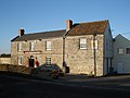
 Catcott, from the church tower | |
| Location | |
| Grid reference: | ST395393 |
| Location: | 51°8’60"N, 2°51’54"W |
| Data | |
| Population: | 517 (2001) |
| Post town: | Bridgwater |
| Postcode: | TA7 |
| Dialling code: | 01278 |
| Local Government | |
| Council: | Sedgemoor |
| Parliamentary constituency: |
Bridgwater & W. Somerset |
Catcott is a small, rural village in Somerset. It lies in the Somerset Levels, close to Edington and 7 miles to the east of Bridgwater.
Catcott is in the portion of the Somerset Levels to the north of the Polden Hills, which begin to rise a little south of the village, raising it that tiny bit above the fields that stretch out flat and broad to the north.
Out on the Levels between Catcott and Burtle lies the hamlet of Catcott Burtle.
Parish church

The parish Church of St Peter dates predominantly from the 15th century, but still includes some minor 13th century work, and has been designated as a Grade I listed building.[1] It was formerly one of the Polden Chapels held under Moorlinch.
In 1548 the church was adjudged to be a chantry chapel and thus liable to closure and sale by Edward VI's commissioners. It was bought by William Coke, who already held the tithes. He armed himself to keep out the parishioners until 1552 when he demolished it. Following a series of court cases he was forced to rebuild the church.[2]
Domesday Book
In the Domesday Book of 1086 Roger de Courcelles held five hides at Catcott, which were recorded with Glastonbury Abbey's Shapwick estate.[3]
Nature
Catcott, Edington and Chilton Moors SSSI is a biological Site of Special Scientific Interest of 2,676 acres, consisting of land south of the River Brue managed by Somerset Wildlife Trust and is known for the variety of the bird life. The site consists of low-lying land which floods on a regular basis
The Tealham and Tadham Moors SSSI is to the north of the Brue. The site is managed by Somerset Wildlife Trust and includes the Catcott Lows National Nature Reserve, of grassland in the summer, but flood during the winter, creating a perfect habitat for wintering waterfowl and Bewick's Swans,[4]
Roe Deer and several invertebrate species of scientific interest also inhabit the area,[5][6] Catcott Heath[7] and Catcott North.[8]
In 1990 Catcott was the winner of the village category of the Britain in Bloom competition.
-
 King William Inn
 -
 Flooded Catcott Heath.
 -
 War Memorial


Outside links
| ("Wikimedia Commons" has material about Catcott) |
References
- ↑ "Church of St Peter". Images of England. English Heritage. http://www.imagesofengland.org.uk/Details/Default.aspx?id=269452. Retrieved 3 December 2008.
- ↑ Bush, Robin (1994). Somerset: The complete guide. Wimborne, Dorset: Dovecote Press. pp. 57. ISBN 1874336261.
- ↑ "Catcott". Victoria County History. British History Online. http://www.british-history.ac.uk/report.aspx?compid=15104. Retrieved 3 December 2008.
- ↑ "Catcott Lows". Somerset Wildlife Trust. http://www.somersetwildlife.org/reserveview.php?id=53. Retrieved 3 December 2008.
- ↑ English Nature citation sheet for the site (accessed 6 August 2006)
- ↑ Brown, Alan. "Catcott Lows NNR". Avalon Marshes Reserve Guides. http://www.glastonbury.eclipse.co.uk/web_site_with_me_00009f.htm. Retrieved 2008-10-18.
- ↑ "Catcott Heath". Somerset Wildlife Trust. http://www.somersetwildlife.org/reserveview.php?id=3. Retrieved 2008-10-18.
- ↑ "Catcott North". Somerset Wildlife Trust. http://www.somersetwildlife.org/reserveview.php?id=20. Retrieved 2008-10-18.