Carreghofa
Jump to navigation
Jump to search
| Carreghofa Welsh: Carreghwfa | |
| Montgomeryshire | |
|---|---|
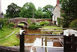
 Carreghofa Locks | |
| Location | |
| Location: | 52°46’37"N, 3°6’4"W |
| Data | |
| Population: | 654 |
| Post town: | Llanymynech |
| Postcode: | SY22 |
| Dialling code: | 01691 |
| Local Government | |
| Council: | Powys |
| Parliamentary constituency: |
Montgomeryshire |
Carreghofa is a township forming a detached part of Denbighshire in eastern Montgomeryshire, adjacent to the border with Shropshire. The township comprises the western half of the ancient parish of Llanymynech, with the eastern half in Llanymynech and Pant in Shropshire. In 2011 the population of Carreghofa was 654 .[1]
To the east lies Llanymynech and Pant; to the south Llandysilio; to the west Llansantffraid; and to the north lies Llanyblodwel.
References
- ↑ Welsh Government website; 2011 Census Returns and stats; accessed 9 May 2014
This Montgomeryshire article is a stub: help to improve Wikishire by building it up.