Baycliff
| Baycliff | |
| Lancashire | |
|---|---|
 Maskel Point | |
| Location | |
| Grid reference: | SD288724 |
| Location: | 54°8’33"N, 3°5’27"W |
| Data | |
| Post town: | Ulverston |
| Postcode: | LA12 |
| Dialling code: | 01229 |
| Local Government | |
| Council: | Westmorland & Furness |
| Parliamentary constituency: |
Barrow and Furness |
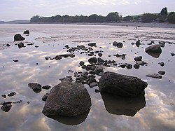
Baycliff is a village in Lancashire, three south of Ulverston on the A5087 road which runs along the coast of Morecambe Bay south from Ulverston. A mile to the south, on the shoreline, is Aldingham (to whose civil parish Baycliffe has been allocated).
At the centre of Baycliff is a village green, and many of its buildings date from the 17th and 18th centuries. There are two public houses, the Farmer's Arms and the Fisherman's Arms, situated close to the green.[1]
History
In the past Baycliff, originally spelled Baycliffe, was a fishing and farming community. The industries of iron mining and local white stone quarrying provided employment for the men of the village. The iron was shipped to Backbarrow.
The village was the birthplace in about 1619 of the prominent Quaker preachers Alice Curwen (maiden name unknown) and her husband Thomas Curwen.[2]
Limestone
Baycliff limestone is still quarried; the quarry beds produce two distinct stones. Lord is oatmeal coloured with dark cream markings; Caulfield is a buff stone with light coffee mottling. It is a versatile material, used to create distinctive, durable floors and attractive paving schemes and is used in landscaping designs.
Outside links
| ("Wikimedia Commons" has material about Baycliff) |
References
- ↑ English Lakes: Baycliff
- ↑ Michael Mullett: "Curwen, Thomas (c. 1610–1680)", Oxford Dictionary of National Biography (Oxford, United Kingdom: OUP, 2004) Retrieved 17 November 2015