Ashley, Wiltshire
Jump to navigation
Jump to search
| Ashley | |
| Wiltshire | |
|---|---|
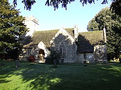
 Ashley Church | |
| Location | |
| Grid reference: | ST932948 |
| Location: | 51°39’9"N, 2°5’57"W |
| Data | |
| Postcode: | GL8 |
| Local Government | |
| Council: | Cotswold |
| Parliamentary constituency: |
The Cotswolds |
Ashley is a village in Wiltshire close by the border with Gloucestershire. It is found about eight miles south-west of Cirencester in the latter county. To the north, across the A433 road in Gloucestershire, is Trull House.
The 2011 census recorded a population of 131.
The Fosse Way, a major Roman road from Cirencester towards Bath, runs to the south-east of the village: here it is a bridleway. For much of its route hereabouts this road forms a straight-line part of the border with Gloucestershire, though Ashley is in a part of Wiltshire across the Fosse Way.
Parish church
The Church of St James was built in the Norman period and rebuilt around 1200. It is a Grade II* listed building.[1]
References
- ↑ National Heritage List 1341134: Church of St James
Outside links
| ("Wikimedia Commons" has material about Ashley, Wiltshire) |
- Ashley in the Domesday Book