Difference between revisions of "Northend, Buckinghamshire"
From Wikishire
(Created page with "{{Infobox town |name=Northend |county=Buckinghamshire |picture=Bridleway, Northend - geograph.org.uk - 686497.jpg |picture caption= |os grid ref=SU735925 |latitude=51.6265 |lo...") |
(No difference)
|
Latest revision as of 15:43, 10 February 2024
| Northend | |
| Buckinghamshire | |
|---|---|

| |
| Location | |
| Grid reference: | SU735925 |
| Location: | 51°37’35"N, 0°56’22"W |
| Data | |
| Post town: | Henley-on-Thames |
| Postcode: | RG9 |
| Local Government | |
| Council: | Buckinghamshire |
| Parliamentary constituency: |
Wycombe |
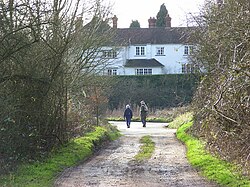
Northend is a village at the very edge of Buckinghamshire, nestling against the border of Oxfordshire, south-west of Ibstone and north-west of Turville Heath: beyond Turville Heath is Southend, a similarly sized hamlet. A western cluster of homes is found up the road towards Christmas Common, just across in Oxfordshire.
| ("Wikimedia Commons" has material about Northend, Buckinghamshire) |