Light House Island
| Light House Island | |

| |
|---|---|
| Location | |
| Grid reference: | J596858 |
| Area: | 40 acres |
| Data | |
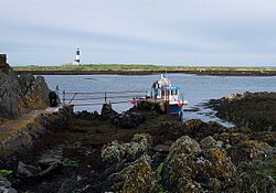
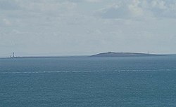
Light House Island or Lesser Copeland Island is the second-largest isle of the Copeland Islands off the coast of County Down. It lies some 4 miles north of Donaghadee. With neighbouring Mew island it forms its own cluster almost a mile north of Copeland Island itself.
A light station was established on the island in the early 18th century, hence its name, and a lighthouse built in 1815. The lighthouse was taken out of service in 1884 but the ruined stump of the 52-foot stone tower remains. The ruins of the keeper's house have been rebuilt to house a bird observatory. The lighthouse was abandoned in favour a site on Mew Island, which is also called Lighthouse Island on occasion.
Name
The name of the island is a delightful ambiguity. It may be called "Lesser Copeland Island". The Ordnance Survey of Northern Ireland mark it as "Light House Island" and for the National Trust it is "Lighthouse Island". On the other hand, "Lighthouse Island" is a name applied also to the neighbouring Mew Island. The Copeland Bird Observatory call their home "Copeland Island", notwithstanding that "Copeland Island" is the name of the larger isle a mile to the south.
Visiting
Light House Island is now owned by the National Trust and operated by the volunteer members of the Copeland Bird Observatory.
Overnight accommodation is available but only by arrangement with the Bird Observatory; access is by arrangement, on a small boat from Donaghadee harbour. The old lighthouse tower is closed.
